

Where Desert Meets the Sea: A Guide to Mexico’s Northwest Pueblos Mágic by Scott Paton - HTML preview
Download the book in PDF, ePub, Kindle for a complete version.
Pueblos Mágicos of Chihuahua: Cultural Treasures
The Pueblos Mágicos program, initiated in 2001 to promote towns with cultural, historical, or natural appeal, has designated 177 such towns across Mexico as of 2023.
In Chihuahua, the program showcases a dramatic diversity of landscapes and heritage—from mountain vistas to archaeological marvels:
● Creel – Sierra Tarahumara gateway, Rarámuri culture, and forested valleys
● Casas Grandes – Paquimé ruins, Mata Ortiz pottery, and Mormon colonial past
● Batopilas – Deep canyon mining town with colonial architecture
● Hidalgo del Parral – Silver-mining history and Pancho Villa legacy
● Guachochi – Waterfalls, canyons, and Rarámuri traditions.
Together, they form a compelling route through Chihuahua's rich tapestry of history, nature, and culture—a living display of Mexico’s enduring spirit.
Creel: Gateway to the Sierra Tarahumara
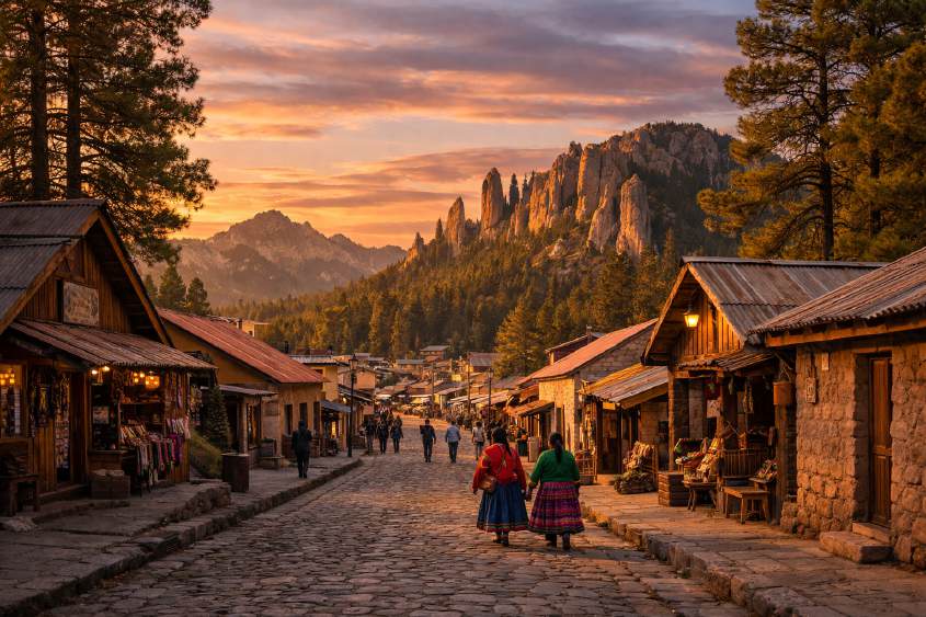
Tucked into the heart of the Sierra Tarahumara, Creel is much more than a stop on the map: it’s the gateway to an entire world of breathtaking landscapes, ancestral cultures, and unforgettable experiences. Founded in 1907 as a railway station along the famous Chihuahua–Pacific line, Creel has become the starting point for adventures into the Copper Canyon, encounters with the Rarámuri people, and explorations of northern Mexico’s most striking natural wonders.
From its lively main square lined with hotels, shops, and cafés, to the surrounding pine forests, lakes, and rock formations, Creel offers visitors a blend of modern comforts and timeless traditions.
History and Origins
Creel was born with the arrival of the Chihuahua al Pacífico Railway—better known as El Chepe. This line opened up access to the remote mountains and brought merchants, travelers, and explorers who quickly transformed Creel into a hub for movement and exchange.
It also became a place where two worlds meet: the modern mestizo town and the communities of the Rarámuri, who have lived in these mountains for centuries. Their language, customs, and way of life remain alive today, giving Creel a unique cultural depth that you won’t find anywhere else.
How to Get There
Creel lies about 260 kilometers from the city of Chihuahua, and is easily reached by both road and rail.
● By car or bus: The drive takes about 4–5 hours from the state capital.
● By train (El Chepe): Creel is one of the highlights of the world-famous Chepe Express,
a panoramic journey between Los Mochis and Chihuahua. With tunnels, bridges, and views over the Copper Canyon, the train ride itself is an unforgettable experience.
Where to Stay
Surprisingly for a small town, Creel has over a hundred lodging options. Choices range from cozy cabins with fireplaces and forest views to centrally located hotels right on the main square.
● Cabins: Ideal if you want quiet evenings surrounded by pines, with the crackle of a fire
to keep you warm.
● Hotels in town: Perfect if you want easy access to restaurants, shops, and the train
station.
Whatever you choose, Creel makes a great base for exploring the surrounding Sierra.
Must-See Attractions
Lake Arareco
Just 5 km from town, Lake Arareco is a calm, pine-fringed lake perfect for kayaking, fishing, or simply enjoying a picnic. Women from nearby Rarámuri communities sell handmade baskets and dolls, adding cultural richness to the natural beauty.
Valleys of Rocks: Mushrooms, Frogs, and Monks
The Sierra has a playful way with stone.
● Valley of the Mushrooms: giant boulders shaped like toadstools.
● Valley of the Frogs: rocks resembling squat amphibians.
● Valley of the Monks (Bisabírachi): towering volcanic formations that look like solemn
monks frozen in prayer.
Sacred to the Rarámuri, these sites are as spiritual as they are photogenic.
San Ignacio de Arareco
This small Rarámuri community is home to a 17th-century Jesuit mission and a haunting cemetery. Some families still live in caves nearby, maintaining traditions that go back generations.
Cusarare Waterfall
At over 20 meters high, Cusarare is one of the region’s most iconic waterfalls. In summer it cascades in full force, while in winter parts of it freeze, creating a magical icy curtain. Close by, the Jesuit mission of Cusarare and a small sacred art museum complete the visit.
Museum of Tarahumara Popular Art
Housed in the old railway station, this museum showcases colorful Rarámuri clothing, violins, drums, baskets, and sacred objects. It also highlights the tradition of Rarámuri long-distance running, made famous by athletes like Lorena Ramírez.
Food and Flavors
Creel’s cuisine reflects the hearty, mountain lifestyle of Chihuahua:
● Machaca burritos made with dried beef.
● Rainbow trout, raised in local cold-water farms.
● Thick-cut steaks and ribeye, the pride of Chihuahua ranchlands.
● Mennonite cheesecake, made with cheeses produced by Mennonite communities in
the region.
Dining in Creel is both comforting and delicious—perfect after a long day of exploration.
Unique Experiences
● Meet the Rarámuri: Buying a bracelet or basket, listening to their language, or simply
observing daily life in their communities offers an authentic cultural connection.
● Bike or hike the trails: From Creel, trails lead to lakes, valleys, and caves, each with a
sense of discovery.
● Ride the Chepe Express: Nothing compares to the thrill of watching the Sierra Madre
landscapes unfold from your train window.
Practical Tips
● Weather: Creel is chilly year-round. In winter, temperatures often drop to –10°C (14°F).
Pack layers and warm clothing.
● Altitude: At over 2,300 meters (7,500 ft), some travelers may need time to adjust.
● Guides: Hiring local guides is recommended for visiting waterfalls or remote
communities safely.
● Respect: Always ask permission before photographing Rarámuri people. Their traditions
deserve sensitivity.
Final Reflections
Creel is more than a Pueblo Mágico—it’s a gateway to the soul of the Sierra Tarahumara. Here, silence has weight, pine forests stretch endlessly, and rocks shaped by millennia whisper stories of time. It is a place where modern travelers can walk alongside ancient traditions, where every step reveals both natural majesty and cultural resilience.
When you leave, you carry not only memories of lakes and valleys, but also the quiet wisdom of the Rarámuri and the wild beauty of northern Mexico. Creel doesn’t just capture your eyes—it captures your spirit.
Batopilas: A Hidden Gem in the Copper Canyon
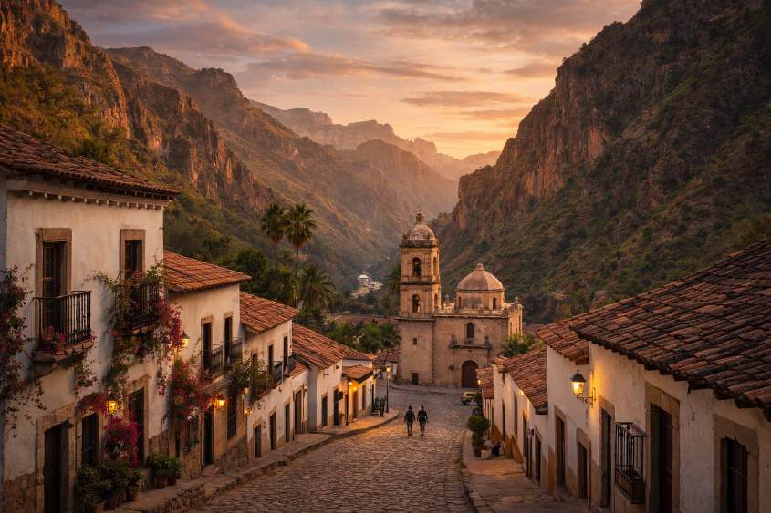
Far below the pine-covered heights of the Sierra Tarahumara, nestled in one of the deepest canyons of the Sierra Madre Occidental, lies Batopilas — a Pueblo Mágico where time seems to slow down. To reach it is an adventure: a winding descent of three hours from Creel, along one of the most dramatic roads in Mexico, with cliffs dropping into infinity and mountains rising like fortresses.
Batopilas, whose name comes from the Rarámuri words meaning “Encased River,” was once a booming silver-mining town. Today, with just over a thousand residents, it feels like stepping back a century, with colorful colonial houses, quiet plazas, and the river flowing steadily at its side.
History and Origins
The first records of Batopilas date back to 1704, when Spanish explorers discovered the rich silver veins that would place the town on the world’s mining map. By the 18th and 19th centuries, Batopilas was one of Mexico’s most productive silver centers, attracting wealthy entrepreneurs and adventurous settlers.
One of the most notable figures was Alexander Shepherd, a former governor of Washington, D.C., who moved to Batopilas in the late 1800s. He built schools, hospitals, and the grand San Miguel Hacienda, turning Batopilas into a prosperous enclave. At its height, the town had electricity before many major cities in Mexico — it was the second town in the country to be electrified.
When the mines declined in the 20th century, Batopilas fell into quiet obscurity. Today, it thrives as a destination for travelers seeking history, nature, and a taste of authentic canyon life.
How to Get There
Reaching Batopilas is part of the adventure.
● From Creel: The most common route is a 140 km road trip, descending nearly 1,800
meters in elevation. The journey takes about 3 hours and includes dramatic switchbacks and canyon overlooks like Mirador de la Bufa.
● By bus or shared van: Local transport options connect Creel and Batopilas, though
schedules can be irregular.
● By car: Driving requires caution; the road is paved but steep and winding. It’s
recommended for confident drivers only.
Where to Stay
Despite its size, Batopilas offers charming accommodation.
● Boutique hotels in restored colonial mansions let visitors sleep in history, with
courtyards and antique furniture.
● Simple guesthouses near the plaza provide budget-friendly stays, often run by local
families.
● Staying by the river allows you to wake to birdsong and the soothing rush of water.
Wherever you stay, expect tranquility and a sense of stepping into another era.
What to See and Do
Explore the Historic Center
Batopilas’ streets are narrow and colorful, lined with bright facades, bougainvillea, and colonial doorways. The main square is the heart of town life, often filled with families and travelers sharing stories.
Visit the Lost Cathedral of Satevó
Just 8 km outside Batopilas lies the Mission of Satevó, nicknamed the “Lost Cathedral” for its isolated setting deep in the canyon. Built by Jesuits in the 18th century, its brick construction and unfinished second tower give it a unique presence. Inside, legends abound — including hidden tunnels once used as escape routes.
Hacienda San Miguel
Once the residence of Alexander Shepherd, this hacienda now stands in romantic ruins across the river. Its weathered adobe walls and arches tell of Batopilas’ mining golden age, when fortunes were made and silver flowed endlessly.
Walk Along the Batopilas River
The river that gave the town its name winds through tropical scenery. Unlike Creel’s pine forests, Batopilas’ climate is almost subtropical — orange, papaya, and guava trees grow here. A riverside walk reveals daily life: locals fishing, children swimming, and farmers tending their fields.
Local Museums
Small exhibits in town display mining artifacts, photographs, and relics of Batopilas’ heyday. They help connect the quiet present with the bustling past.
Food to Try
The canyon’s warmer climate shapes its cuisine. Look for:
● Traditional enchiladas and gorditas, often stuffed with beans or chicharrón.
● Locally grown fruits — oranges, papayas, and bananas flourish here.
● River fish dishes, simply prepared but full of flavor.
● And like in much of Chihuahua, you can’t go wrong with a good burrito.
Meals are best enjoyed slowly, in the open air, with the sound of the river nearby.
Practical Tips
● Climate: Batopilas sits at 500 meters above sea level, much lower than Creel. Expect
warm, almost tropical weather — pack light clothing, but bring a jacket for evenings.
● Connectivity: Internet and phone service can be patchy. It’s a place to disconnect.
● Cash: ATMs are limited; bring cash from Creel or Chihuahua City.
● Respect: Many Rarámuri families live in the surrounding canyons. Approach with
sensitivity and always ask before taking photos.
Closing Reflection
Batopilas is the kind of place that rewards those who take the road less traveled. Reaching it means navigating dizzying canyon roads, but the reward is profound: a town of colorful houses, rich history, and a river that whispers stories of centuries past.
Here, you don’t just visit a destination — you step into a living memory of Mexico’s mining age, tempered by the resilience of the Sierra Tarahumara and the warmth of its people.
Leaving Batopilas, you’ll carry with you the image of the Lost Cathedral against the canyon sky, the taste of fresh oranges by the river, and the feeling of having touched one of Mexico’s best-kept secrets.
Hidalgo del Parral: Echoes of Silver and Revolution
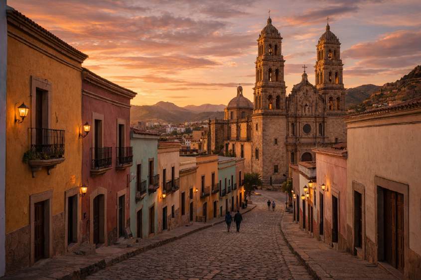
Set in the southern reaches of Chihuahua, surrounded by rugged hills and desert skies, Hidalgo del Parral — or simply Parral — is a town where history clings to every stone. Once the “Capital of the World in Silver,” Parral thrived as a mining hub during colonial times. Later, it became forever linked to the Mexican Revolution as the place where General Francisco “Pancho” Villa met his dramatic end.
Today, Parral blends colonial architecture, cultural treasures, and a vibrant local life. Its plazas, theaters, and mansions recall an era of grandeur, while museums and monuments connect visitors with Mexico’s turbulent revolutionary past.
History and Origins
Parral was founded in 1631, when the discovery of rich silver veins at Mina La Prieta turned the area into one of the most prosperous mining centers of New Spain. Silver caravans flowed south along the Camino Real de Tierra Adentro, linking Parral to the wider world.
Over time, Parral became not only a mining capital but also a political stage. It briefly served as the capital of the Nueva Vizcaya province and even hosted President Benito Juárez during his flight from invading forces. In 1923, the town’s history took another dramatic turn when Pancho Villa was ambushed and killed here — a story that still echoes in its streets and museums.
How to Get There
● From Chihuahua City: Parral is about 220 km south, a 3.5-hour drive by car or bus.
● From Durango: Roughly 2.5 hours by road, making it a crossroads town between
states.
● By bus: Frequent routes connect Parral to major cities in northern Mexico.
Where to Stay
Parral offers a wide variety of accommodations:
● Historic hotels near the main plaza, with balconies overlooking the cathedral.
● Simple inns and guesthouses for budget travelers.
● Boutique stays inside restored colonial homes, complete with antique furniture and
courtyards.
Visitors often find themselves within walking distance of the town’s most iconic landmarks.
What to See and Do
Mina La Prieta
The silver mine that gave Parral its glory now operates as a museum. Guided tours take visitors 87 meters underground into tunnels, offices, and workshops, revealing centuries of mining history.
Palacio Alvarado Known as the “Monument to Love,” this lavish mansion was built in the early 1900s by silver baron Pedro Alvarado for his wife. Today it houses a museum filled with ornate furniture, stained glass, and artwork — a glimpse into the life of Mexico’s mining elite.
Museo Francisco Villa
On the very spot where Pancho Villa was assassinated, this museum preserves artifacts, photos, and the story of the revolutionary leader’s final moments. A visit here is both haunting and illuminating.
Teatro Hidalgo
With its neoclassical façade and rich history, this theater is one of Parral’s cultural gems. Once a convent and later a military barracks, it now serves as a venue for art and performance.
San José Parish
Built between 1673 and 1686, this baroque parish church dominates the main square. Inside lie the remains of Juan Rangel de Biezma, founder of Parral.
Side Trips
● Valle de Allende: Famous for a meteorite that landed in 1969, as well as hot springs
and tranquil landscapes.
● Santa Bárbara: A nearby mining town with museums and colonial churches, worth a
half-day visit.
Food to Try
Parral’s food is hearty and flavorful:
● Gorditas de la Catedral: Thick corn or flour pockets stuffed with fillings like shredded
beef, chile verde, or chicharrón.
● Frijoles con queso and asado de puerco are local staples.
● Traditional sweets: Stop by La Gota de Miel, a beloved candy shop offering dulces de
leche with nuts, Jamoncillos, and other Mexican treats.
Practical Tips
● Weather: Summers are warm, while winters can be chilly — pack layers.
● Events: Each July, Parral hosts the Festival de Villa, including reenactments of Pancho
Villa’s death.
● Souvenirs: Local silver jewelry and regional sweets make meaningful mementos.
Closing Reflection
Hidalgo del Parral is a place where silver veins, revolutionary bullets, and cultural pride converge. Walking its cobblestone streets, you move between centuries: from the baroque church façades of the 1600s, to the mansions of silver barons, to the revolutionary spirit of Pancho Villa.
It is not a polished, tourist-perfect town; it is something richer — authentic, layered, and alive with history. Parral is the kind of place that leaves you with a deeper understanding of Mexico’s soul: resilient, passionate, and forever tied to the land.
Casas Grandes: Legacy of Paquimé and Living
Traditions
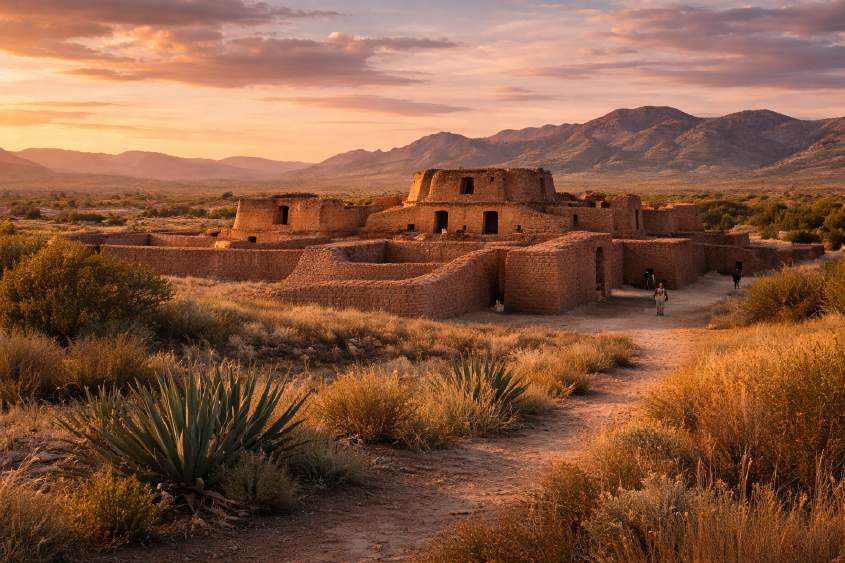
In the northwestern corner of Chihuahua, surrounded by desert plains and distant mountains, lies Casas Grandes, a Pueblo Mágico that holds some of Mexico’s most remarkable pre-Hispanic heritage. Here, the ancient city of Paquimé once flourished, a cultural and commercial hub that connected northern Mexico with the American Southwest. Today, visitors encounter not only extraordinary archaeological remains but also thriving traditions, like the world-renowned pottery of Mata Ortiz.
Casas Grandes is more than a town — it is a living bridge between past and present, where desert landscapes, indigenous history, and local creativity combine in unforgettable ways.
History and Origins
The roots of Casas Grandes reach back to 600 CE, when the Paquimé civilization emerged in the desert. By the 13th century, the city had reached its peak, with multi-story adobe buildings, advanced water distribution systems, and ceremonial centers. Spanish explorers arriving in the 1560s described structures of “great size and strength,” some rising up to seven stories.
By the time of the conquest, Paquimé had already been abandoned, but its legacy lived on. In 1998, UNESCO recognized the site as a World Heritage Site, cementing its place as one of the most important archaeological zones of northern Mexico.
Later, in the late 19th century, Casas Grandes also became home to Mormon colonies, whose descendants still live in the nearby settlements of Colonia Juárez and Colonia Dublán.
How to Get There
● From Chihuahua City: About 4.5 hours by car (roughly 280 km).
● From Ciudad Juárez: 3.5 hours south by highway.
● By bus: Routes connect Nuevo Casas Grandes (the modern city) with other northern
towns, from where local taxis can take you to the Pueblo Mágico and archaeological sites.
Where to Stay
Most lodging options are located in Nuevo Casas Grandes, just 10 minutes away, offering modern hotels with comfortable rooms. In Casas Grandes itself, visitors can find smaller inns, rustic cabins, or family-run guesthouses, perfect for travelers seeking a more personal experience.
What to See and Do
Paquimé Archaeological Site
The jewel of Casas Grandes is undoubtedly Paquimé, the ancient city of adobe walls, ceremonial enclosures, and multi-story buildings with T-shaped doorways. Highlights include:
● The House of the Macaws, where over a hundred scarlet macaws were found buried as
part of ritual practices.
● The House of the Serpents, adapted for animal breeding.
● The unique Casa de los Hornos, linked to food and drink production. Walking through Paquimé feels like entering a labyrinth shaped by time and desert winds.
Museum of Northern Cultures
At the entrance to the site stands a semi-subterranean museum designed by Mario Schjetnan, awarded in Buenos Aires in 1995 for its integration with the landscape. Inside, over 2,000 artifacts — pottery, tools, and agricultural implements — tell the story of Paquimé and neighboring cultures.
Mata Ortiz
Only 35 km away, Mata Ortiz is world-famous for its pottery tradition. Inspired by Paquimé designs, artisans here produce hand-shaped, hand-painted ceramics of extraordinary beauty. No wheels or molds are used — each piece is crafted entirely by hand, painted with natural pigments, and fired in rustic kilns. Collectors from around the world prize Mata Ortiz pottery as both art and cultural heritage.
Mormon Colonies
● Colonia Juárez: Known for its Victorian architecture, including the historic Academia
Juárez (1904) and a modern Mormon temple.
● Colonia Dublán: With fertile orchards producing peaches and apples, this settlement
highlights the agricultural tradition of Mormon pioneers.
Cueva de la Olla
About 70 km from Casas Grandes, this archaeological site is named after a massive adobe granary shaped like a giant clay pot, built to store maize. Dating back thousands of years, it offers a rare glimpse into desert survival strategies.
Food to Try
Casas Grandes offers flavors as rich as its history:
● Carne seca (dried beef) and barbacoa prepared with local spices.
● Sotol, a traditional distilled spirit of Chihuahua, sometimes infused with snake for
medicinal purposes.
● Fresh peaches and apples from Mormon orchards.
● Local snacks like cuajadas (curds) paired with tortillas or roasted chile.
Practical Tips
● Weather: This is high desert country. Days can be hot, while nights are chilly — pack
accordingly.
● Guides: Hiring a certified guide for Paquimé or the Valley of Caves adds depth and
context to your visit.
● Respect: Sites like Cueva de la Olla are fragile — avoid touching or climbing structures.
● Souvenirs: Mata Ortiz pottery is not just a souvenir; it’s a collectible piece of living
heritage.
Closing Reflection
Casas Grandes is where history speaks through clay and stone. From the labyrinthine ruins of Paquimé to the delicate brushstrokes of Mata Ortiz pottery, this Pueblo Mágico invites visitors to stand at the crossroads of ancient and modern worlds.
It is a place of resilience — where desert dwellers built thriving civilizations, where settlers cultivated orchards in barren lands, and where artisans continue to shape earth into art.
Visiting Casas Grandes is not only an exploration of Chihuahua’s past, but also a celebration of how tradition survives and transforms. It is proof that culture, like clay, can be molded anew without losing its essence.
Guachochi: Heart of the Sierra Tarahumara
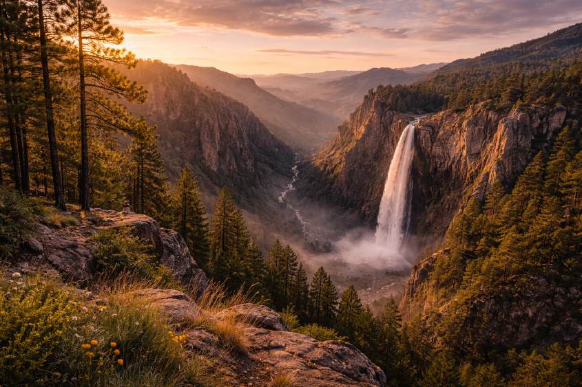
High in the Sierra Tarahumara, surrounded by forests, waterfalls, and dramatic canyons, lies Guachochi — a Pueblo Mágico whose name in the Rarámuri language means “Place of Herons.” Known as the capital of the Sierra Tarahumara, Guachochi is a cultural and natural jewel, where the traditions of the Rarámuri people live side by side with awe-inspiring landscapes.
This town is not only a gateway to breathtaking natural wonders like the Sinforosa Canyon, but also a stage for one of the most legendary endurance events in the world: the Ultramarathon of the Canyons, where Rarámuri runners showcase their almost superhuman stamina.
History and Origins
Guachochi’s roots are deeply tied to the Rarámuri, the indigenous people of the Sierra Tarahumara. For centuries, they have lived in caves and remote communities, maintaining traditions, rituals, and a unique worldview. Spanish missionaries later established missions in the area, but the rugged terrain preserved much of the indigenous culture.
Today, Guachochi is both a modern town and a cultural center, where Rarámuri families come to trade, celebrate, and share their heritage with visitors. In 2023, it officially received the designation of Pueblo Mágico, recognizing its cultural richness and natural beauty.
How to Get There
● From Chihuahua City: The drive takes about 5 hours (350 km) through winding
mountain roads.
● From Parral: Roughly 2.5 hours south by car.
● By air: Guachochi has a small airstrip, served occasionally by private and regional
flights.
The journey itself is spectacular — winding through pine forests, open plateaus, and glimpses of the canyons.
Where to Stay
Guachochi offers a range of accommodations:
● Hotels near the main plaza, with modern comforts.
● Cabins and eco-lodges near lakes and waterfalls, perfect for travelers seeking nature
immersion.
● Community-based stays that allow direct contact with Rarámuri traditions.
Wherever you stay, you’ll find warmth and hospitality — hallmarks of this mountain town.
What to See and Do
Lago de las Garzas
This peaceful lake, lined with pine trees, is a favorite spot for locals to relax, kayak, or stroll along the shore. At one end, a monument to the heron — the town’s symbol — stands watch. The lake flows into El Salto Waterfall, creating a picturesque scene.
El Salto Waterfall
Just minutes from town, this double-drop waterfall cascades nearly 25 meters. In the mornings, sunlight often creates rainbows in the mist — a sight that feels nothing short of magical.
Sinforosa Canyon
Known as the “Queen of the Canyons”, the Sinforosa is one of the deepest gorges in the Sierra Tarahumara, plunging more than 1,800 meters from rim to river. Hiking trails and viewpoints allow you to appreciate its vastness. Each July, the canyon becomes the stage for the Ultramarathon of the Canyons, where Rarámuri runners race incredible distances in their traditional huaraches.
Pinabete Sanctuary
An hour from Guachochi lies this natural reserve, named after towering pinabete trees (a local fir species). Trails lead to hidden waterfalls, crystal-clear streams, and eco-projects that highlight the region’s biodiversity.
Cocoyome Ecotourism Park
Perched halfway down a canyon, Cocoyome combines rustic cabins, zip-lines, and dramatic waterfalls. It’s an ideal place to disconnect, surrounded by cliffs and the sound of rushing water.
Food to Try
Guachochi’s cuisine reflects both mountain traditions and Rarámuri staples:
● Trout: The town is one of Chihuahua’s leading producers of rainbow trout, often served
grilled or wrapped in foil with vegetables.
● Muni’p posole: A hearty stew of beans and maize, unique to the Rarámuri.
● Gorditas and enchiladas serranas, filled with beans, cheese, or chile colorado.
● Seasonal treats like apple- or peach-based desserts, from orchards in nearby valleys.
Practical Tips
● Weather: Summers are mild (25–30°C), while winters can drop to –10°C. Bring layers,
especially if visiting the canyons.
● Altitude: At 2,400 meters above sea level, Guachochi can leave visitors breathless at
first — take it slow.
● Events: The Ultramarathon of the Canyons (first week of July) is a unique chance to
witness Rarámuri running culture.
● Respect: The Rarámuri maintain strong traditions. Always ask before photographing
people, and respect sacred sites.
Closing Reflection
Guachochi is a place of contrasts: peaceful lakes and thunderous waterfalls, quiet plazas and legendary ultramarathons, ancient traditions and modern Pueblo Mágico recognition.
Here, travelers encounter not just landscapes of staggering beauty but also the enduring spirit of the Rarámuri, whose resilience and harmony with nature are lessons worth carrying home.
Leaving Guachochi, you’ll remember the vast silence of the Sinforosa, the taste of fresh trout by the lake, and the feeling of standing at the very heart of the Sierra Tarahumara.