

The Desclergues of la Villa Ducal de Montblanc, Second Edition Omnibus by Nico Declercq - HTML preview
Download the book in PDF, ePub, Kindle for a complete version.
The Desclergues of la Villa Ducal de Montblanc, 2nd ed., Omn., VOL. IV
54.6. FURTHER EVIDENCE OF THE CARVALHO FAMILY AT GOA
1073
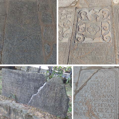
Figure 54.49: From left to right, top to bottom, four interesting tombstones are shown. First, we
see the grave inside the Se Cathedral of Goa Velha of Josef Duarte Carvalho, 1781. Second, the tomb
is shown of Carvalho inside the Saint Augustin Church (established in 1602) of Goa Velha. It states
’Sepultura de Andre Carvalho e de seus frdliros fallceo’ . The typical Carvalho shield is visible. This Carvalho must have been related, though through a different branch, with Juan Carvalho de Silva.
Note that the shield of Carvalho looks like a flower, but it consists of a star and moons. Third, a
plaque is shown, which is exposed at Goa Velha, near the Archeological Museum. It mentions de Silva
(’Da Silva’) and also Carvalho. Finally, Carvalho’s grave appears inside the Saint Augustin Church
(established in 1602) of Goa Velha. It states, ’Sepultura de Cavalho ed de IXXI Aures F.E Isabela
ur.se de seus er... 21 de Dezembro 1629’ . (Goa, 2019) (Declercq de Silva Archive)
all confirmed that the two persons are indeed males, of around 20 years old.
Apart from the experienced Indian eye immediately identifying the figures as males, we can mention, for instance, that, in general, females would not show their naked legs. They would also wear more jewels and explicitly expose visible female features. The hairstyle is that of princes, similar to that of the Lord Buddha. The two sons wear a cape attached to the breast with a probably metal cross.
A facial comparison with Shirani de Silva’s father, O. Belin de Silva, is given in Figure 54.48.
54.6 Further evidence of the Carvalho family at Goa
The shield of Carvalho consists of an 8-pointed star with four crescent moons:
’De azul, com uma estrela de ouro de oito raios, encerrada numa caderna de crescentes de prata.’
Together, they form a rose, which is also a symbol of Carvalho. Relics in Goa are shared in Figures 54.49 and 54.50.
54.7 Zameer Khan’s Insights on Portuguese Burghers
Before we continue, as introductory knowledge, it’s interesting to mention Zameer Khan’s insights on the formation of the Portuguese Burgher community in Sri Lanka. His description is congruent with our discoveries and with our DNA analysis. We may quote Zameer Khan’s interview on Sri Lankan television in 2021 when our book was almost ready21.
’The ’burghers’ were formed during the settlement of the Portuguese in Sri Lanka as a result of consensual and non-consensual relationships with the natives of our island. There was a community formed during the Portuguese period on our island, which was of mixed Ceylonese and Portuguese descent. Those people were (then) referred to as mestizos and various other terms. The Casados were the soldiers who married the Sri Lankans, and their descendants were also referred to as the mestizos. They were all part of the Portuguese Burgher community, as we call it today. But back then, they were known under various terms. They were the Luso-Asians or those of Portuguese and Ceylonese descent. Likewise, many came from Goa, which was the ecclesiastical capital 21Dr. Tuan M. Zameer Careem Khan, discussion in ’Ceylon’s Portuguese Burghers; the jovial bunch,’ hosted by Hassaan Shazuli in The Lost & forgotten, Newsfirst Sri Lanka, March 12, 2021.
The Desclergues of la Villa Ducal de Montblanc, 2nd ed., Omn., VOL. IV
© 2024 Nico F. Declercq
1074
CHAPTER 54. RECENT FAMILY HISTORY OF SHIRANI DE SILVA
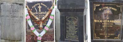
Figure 54.50: Modern graves in Goa, of Amelina Carvalho, Joao Carvalho, an
Albuquerque, in which the Delta or Lambda symbol is incorporated, and Nicolau
Albuquerque. (Goa, 2019) (Declercq de Silva Archive)
of Portuguese India. So, many people from Goa came and settled in our country.
During the Dutch colonial period, the Dutch Burgher community was formed. The Dutch used the term ’Burgher’ to refer to the town dwellers or the free settlers. Because the Portuguese were involved in all kinds of jobs in the military and the government, craftsmanship, etc., the Dutch started to call those Portuguese Burghers the ambachtslieden. Those Portuguese were a reserve militia for the Dutch and involved in carpeting, smithing, leader-making, shoemaking, etc.
During the Dutch period, there was a policy that if the Portuguese wanted to leave the country, they had to leave behind their widows and unmarried women so the Dutch could marry them. The Dutch freemen or Burghers, who came from various European countries, not only the Netherlands, married those women in our country. Even the Dutch Burgher community has Portuguese roots. Likewise, the Portuguese Burgher community does have Dutch ancestry.’
For the Goa connection, we can redirect the reader, for instance, to Chapter 54.9. At the same time, for DNA analysis showing Iberian as well as VOC links, we can, for example, refer to Chapter 74.6 and Chapter 74.16.
54.8 Luso Indians and Evidence in Uduwara, Sri Lanka
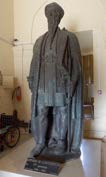
Politicos dos casamentos was the policy imposed by Afonso de Albuquerque, shown in Figure 54.52, to encourage Portuguese soldiers in India to marry local women. Later, to help populate the new Portuguese areas in India, the Portuguese sent many female orphans, called ’Orphans of the King.’ They were sent to marry Portuguese soldiers or local men of high status.
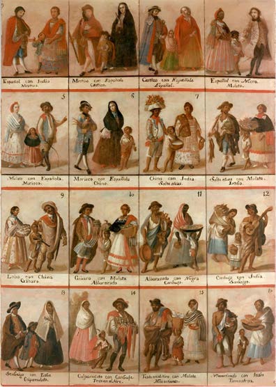
Statues and paintings show how early settlers and the first mestizos dressed on official occasions, but little is known about their daily outfits. Figure 54.51 may offer an impression.
Goa was the Portuguese capital of the East and had the nickname ’Rome of the East.’ To the Portuguese, it was what Malacca used to be for the Muslims and what Batavia would be for the VOC.
Because of Goa’s rich cultural history, including the long Portuguese period, there is a population called ’Luso Indians.’ They have Portuguese ancestors primarily mixed with Gaud Saraswat Brahmin origin families.
Shirani de Silva’s DNA is a blend of the Gaud Saraswat Brahmins and the Kshatriya caste. Indeed, in Chapter 54.3, it is described that Shirani de Silva’s mitochondrial DNA stems from the Kshatriya caste, while autosomal links have been found with the Gaud Saraswat Brahmins. These are, traditionally, the two highest classes of India. Geographically, the Gaud Saraswat Brahmin origins also match the Kuru Kingdom, which is believed to be the origin of the Karava caste of Sri Lanka. Therefore, the first generations of the de Silvas in Uduwara in Sri Lanka must have easily been associated with the Karava.
Today, more than 50000 people are believed to speak Portuguese in Goa. There are no longer Portuguese newspapers in Goa, but associations encourage cultural exchange with Portugal.
In the context of the early mix of the Portuguese ancestors with Brahmins, it is of fundamental importance to mention that the ancestral home of Shirani de Silva (probably not dating back to Portuguese times, but constructed in Portuguese style) had a cemented swastika, high on the outer wall. The swastika symbol is found in India, such as the Brahmins, and in Europe during Roman times. It may be that this tradition dates back to their mixed origins in Goa. Indeed, a Swastika on a home is non-existent in Sri Lanka. It sometimes appears in Hindu temples but not in homes.
It may also have been a tradition taken from Europe. In Europe, we also find this symbol (before the 20th century) in Conimbriga, a city in Coimbra that is a universal symbol found in Roman ruins. Coimbra is where Shirani de Silva’s ancestors may have lived before migrating to India and Sri Lanka. Perhaps more importantly, given the assumed Royal roots of the de Silva clan, through the de Silva family as well as through the Carvalho family, one can find the Swastika on the floor of the Villa Romana la Olmeda in Palencia in Leon, to where indeed the de Silva family refer their royal roots.
As found at the Olupath House of Uduwara, sculptured heads are prevalent in Baroque art. In Asia, the Baroque appeared first in Goa, India, and later in Sri Lanka. For instance, in the church of Bom Jesus in Goa, sculptured heads are depicted similarly to the ones at the Olupathage in Uduwara in Sri Lanka. Also, the other ornaments, as described further, refer to Goa.
The early Portuguese literature on this matter also applies to the arrival of Karava people from India, with the Portuguese, through Goa and Mannar. The first Olupathage de Silva family was formed at Goa and migrated to Uduwara. They lived at the newly constructed fortress of Uduwara with local allies who also took the name Olupathage after the building was erected there. Indeed, the clan of Kuru descent must have adjusted to Sri Lankan customs for better integration and took a ge-name as is expected for Karava.
All the mixes are uncovered in autosomal DNA results, revealing Singhalese ancestors, Indians from Goa, and Portuguese. Note that all Sri Lankans ultimately come from India. As stated elsewhere, the Karava arrived in many migration waves from different Indian areas, the last during the Portuguese era.
© 2024 Nico F. Declercq
The Desclergues of la Villa Ducal de Montblanc, 2nd ed., Omn., VOL. IV
54.8. LUSO INDIANS AND EVIDENCE IN UDUWARA, SRI LANKA
1075
Figure 54.51: The daily outfit of early mestizos and mixed couples in Spanish or
Portuguese overseas territories. We do not know how reliable the images are, but
they show how the literature presumes how they were dressed.
Figure 54.52: Statue of Affonso de Albuquerque at the Archaeological Museum
of Goa. (Goa, 2019) (Declercq de Silva Archive). The Albuquerque family is still
ubiquitous in Goa, as seen in Figure 54.50.
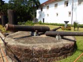
Figure 54.53: Portuguese cannons are stationed outside the archaeo-
logical museum of Goa. (Goa, 2019) (Declercq de Silva Archive)
The Desclergues of la Villa Ducal de Montblanc, 2nd ed., Omn., VOL. IV
© 2024 Nico F. Declercq
1076
CHAPTER 54. RECENT FAMILY HISTORY OF SHIRANI DE SILVA
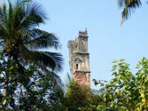
Figure 54.54: A tragic view on old splendor: remains of the tower of
the church of Saint Augustine at Goa (1602). (Goa, 2019) (Declercq
de Silva Archive)
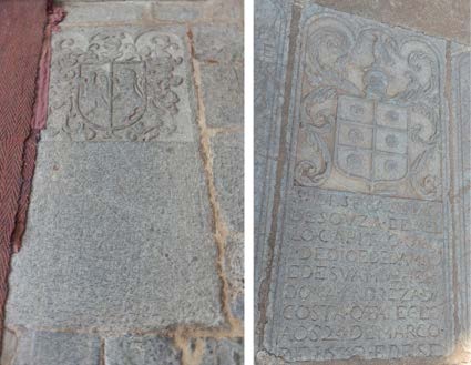
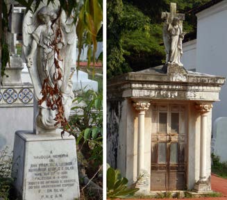
Figure 54.55: Left is the grave of a D’ Aguila y de Silva inside the Se Cathedral of
Goa Velha. Right is the one inside the Saint Augustin Church (established in 1602) of
Goa Velha, of Sebastiao de Souza de Mello (1630), who was a captain, and his wife, doña
Andreza da Costa. (Goa, 2019) (Declercq de Silva Archive)
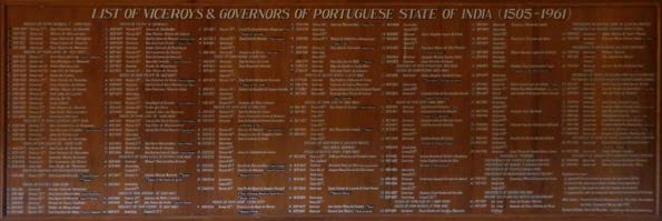
Figure 54.56: Plaque with a list of viceroys and governors of the Portuguese state of India (1505 - 1961), exposed at the archaeological museum of Goa. (Goa, 2019) (Declercq de Silva Archive)
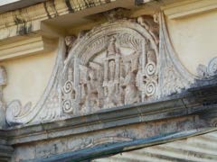
Figure 54.57: A detail of the Saint John’s convent at
Goa building is a sculpture with two towers and two lions
visible. The lions may refer to the construction’s spon-
sors, perhaps the Torres and de Silva families. (Goa,
2019) (Declercq de Silva Archive)
© 2024 Nico F. Declercq
The Desclergues of la Villa Ducal de Montblanc, 2nd ed., Omn., VOL. IV
54.8. LUSO INDIANS AND EVIDENCE IN UDUWARA, SRI LANKA
1077
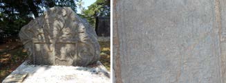
Figure 54.58: Left, he rampant de Silva
lion on a weapon shield exposed at the
Archeological Museum of Goa. Right, the
Tomb inside the Saint Augustin Church
(established in 1602) of Goa Velha, of Hen-
rique Roiz da Silva and his descendants,
1627.
(Goa, 2019) (Declercq de Silva
Archive)
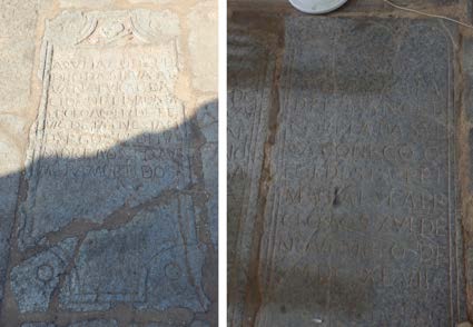
Figure 54.59: The left is the grave inside the Saint Augustin Church (established in
1602) of Goa Velha, of Pedro da Silva Alva (natural da cidad de Lisboa). The right is the
one inside the Se Cathedral of Goa Velha, of Father Manoel Corria da Sylva, MDCXCVII.
(Goa, 2019) (Declercq de Silva Archive)
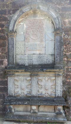
Figure 54.60:
Sculpture inside the Saint Augustin
Church (established in 1602) of Goa Velha. We see three
lion heads at the bottom and an ornament at the top
found at Uduwara in Sri Lanka. Besides, the shield is
similar to that of ’de Silva’ , but from the Castelo Branco
family, with the following text underneath: Non Indi-
get Armis / Esta capela he de dom Jorge de Castelo
Branco he de sva molher dona Maria Enriq Vesh e de
seus herdeiros. Probably dona Maria Enriqu Vesh was of
Flemish descent (’Maria Hendrica Visch’). (Goa, 2019)
(Declercq de Silva Archive)
The Desclergues of la Villa Ducal de Montblanc, 2nd ed., Omn., VOL. IV
© 2024 Nico F. Declercq
1078
CHAPTER 54. RECENT FAMILY HISTORY OF SHIRANI DE SILVA
Figure 54.61: The left is a modern grave
at Goa of Ana Francisca Leonor Mar-
garida Afonso de Silva (1916). The right
is a modern grave of the families de Silva,
Telles, and Corea at Santa Inez cemetery
of Goa. (Goa, 2019) (Declercq de Silva
Archive)
Figure 54.62: As one can see, the fam-
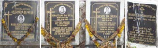
ily name Da Silva is much more common
in Goa than De Silva. A modern grave at
Goa of Manuel Santan d’ Silva. The name
is similar to Shirani’s brother, Santa de
Silva. Although Da Silva is more preva-
lent in Goa than De Silva, a modern fam-
ily grave, ’De Silva - Fernandes,’ is also
exposed. (Goa, 2019) (Declercq de Silva
Archive)
54.9 Link with Goa in India
It is known that the Karava and Salagama arrived in Sri Lanka mainly from the 13th until the 16th century. They came from the Malabar coast, Kerala, and the Coromandel coast of India22.
This influx appeared in pulses, the last during the Portuguese period when they brought clans from Goa, Cochin, and Calicut.
In particular, the Karava clan, which would later become Olupathage and would, through mixed marriages with the Salagama, become members of the Salagama caste during the VOC period, was brought in from the Goa area in India, some of which were the descendants of a mixed marriage with a Portuguese de Silva. Indeed, the Salagamas, also known as Saliyas or Chalias, are found in Kerala adjacent to modern Goa, and they speak Kanada just like the Goans. We may assume that the old population of Uduwara in Sri Lanka, mostly Salagamas, descend from Goans. Interbreeding resulted in their having Portuguese ancestors. Simultaneously, the Olupathage de Silva are paternal descendants of Portuguese and have autosomal DNA from Goans and Portuguese through interbreeding. Additional mixing with locals naturally resulted in DNA traces of the other Singhalese in the area. Some recent insights from Zameer Khan on this matter can be read in Chapter 54.7.
Goan impressions from that era are shown in Figures 54.53, 54.54 and 54.55.
54.9.1 de Silva Governors of Goa
All the viceroys and governors of the Portuguese ’Estado da India’ are shown in Figure 54.56. Here, we only focus on the ones of de Silva.
54.9.1.1 Pero da Silva
Pero da Silva (Pere de Silva y Rivera , Pedro de Silva, Peiris de Silva, Perez de Silva), Viceroy, 1635 - 1639 (dead at Goa in June 1639). He was a blood-relative of Shirani de Silva, as mentioned in Chapter 54.5.24.
54.9.1.2 Joao da Silva
Joao da Silva (Juan de Silva Telo y Meneses, conde de Aveiras), 1640 - 1644 (returned to Portugal) and again in 1651, but died at Mozambique en route to India. Juan de Silva Telo is also mentioned, for instance, by Jean Louis Hubert Simon23, which focussed on the ongoing crisis at that time in Ceilao because Negombo had fallen. The Portuguese wanted to combat the VOC.
54.9.2 Other de Silvas in Goa
We added a list of de Silvas and Carvalhos who have been involved in the Portuguese conquest of Asia (mainly India) in the era covered by the books ’Decadas da Asia,’ by Joao de Barros (1496-1570). This can be found in Chapter 61.3, where a brief recapitulation is given about the construction of the fort at Uduwara by Antonio Carvalho de Silva. Some images of interest in this context, taken at Goa, are shown in Figures 54.57, 54.58, 54.59, 54.60, 54.61 and 54.62. For Goa, we can list the following persons.
22Metiwala Walawwe Chulani Niranjana Kumari Rambukwella, ’Heritage representation in culturally diverse societies: a case study of the Colombo National Museum in Sri Lanka,’ doctoral thesis at the School of Museum Studies, University of Leicester, United Kingdom, 2014.
23Jean Louis Hubert Simon, ’Histoire des naufrages, ou, Recueil des relations les plus intéressantes des naufrages’ .
© 2024 Nico F. Declercq
The Desclergues of la Villa Ducal de Montblanc, 2nd ed., Omn., VOL. IV
1079
54.9.2.1 Luis de Silva Barreto
Luis de Silva Barreto, the son of Francisco Barreto and a mother named ’de Silva.’ Luis was killed in 1569 at Goa during a duel24.
54.9.2.2 Edouard Sylva
Edouard Sylva left Goa for China in 1552.25
54.9.2.3 Melchior de Sylva
Melchior de Sylva was a priest in Goa in 1597.26
54.9.2.4 Pedro de Sylva
Pedro de Sylva appeared in a reference on Goa in 1552, in the context of his role as former Governor of Malacca and in setting up trade between India, Trincomalee and China27.
54.9.2.5 Juan de Silva, the ruler of Manila
Juan de Silva, a distinguished Spanish military leader and governor of the Philippines, held office from April 1609 until his death on April 19, 1616, in Malacca. Originating from the noble de Silva family, who remained in Iberia during the early 1600s, he was a descendant of Aires Gomes de Silva, akin to Shirani de Silva. Born in Trujillo, Extremadura, Spain, de Silva was a knight of the esteemed Order of Santiago.
De Silva assumed the position of governor and captain-general of the Philippines during Easter of 1609. Upon his arrival, he brought five additional companies of troops to reinforce the Spanish military presence in the region. His tenure was marked by significant military engagement, notably against Dutch forces in the Far East. His reputation for courage and steadfast resolve was well-earned during these conflicts.
In 1611, de Silva led an expedition to counter the Dutch presence in the Moluccas. Although the mission achieved limited success, it did manage to capture Sabougo on Gilolo and establish a fortification there. De Silva’s overarching goal was to secure Portuguese assistance in expelling the Dutch from the region. In pursuit of this objective, he dispatched Cristobal de Azcueta, the former governor of Ternate, to Portuguese India in 1612 to coordinate with the Viceroy for a joint military operation. However, the expedition ended tragically with a shipwreck between Manila and Macao.
Undeterred, de Silva sent Jesuit ambassadors to Goa in another attempt to secure Portuguese support. By 1615, the envoys had successfully negotiated an agreement with the Portuguese Viceroy, who committed to providing four large galleons for the campaign in Malacca. Despite this arrangement, the Portuguese ships arrived later. Nevertheless, de Silva proceeded with his plan, against the advice of his officials, and set sail for Malacca on February 9, 1616. He commanded a formidable fleet of ten ships, four galleys, and several smaller vessels, with the 1,700-ton San Marcos serving as the flagship. The fleet carried 5000 men, including 2000
Spaniards and 500 Japanese troops, and was equipped with 300 cannons and accompanied by six Jesuits. This represented the largest European naval force seen in the region at the time.
The fleet’s mission was to rendezvous with the Portuguese armada in the Strait of Malacca and subsequently attack Dutch positions in Java and the Moluccas. However, before their arrival, the Portuguese fleet was decimated by a Dutch attack near Malacca, leading to the destruction of their galleons. On February 25, 1616, de Silva’s fleet reached the Strait of Singapore. He then dispatched Juan Gutierrez Paramo and part of the fleet to reinforce Ternate in the Moluccas.
Governor de Silva’s health, already compromised, deteriorated rapidly, culminating in his death on April 19, 1616, in Malacca.
Consequently, the Spanish expedition had to be abandoned without achieving its objectives against the Dutch. By June 1, 1616, the fleet returned to Manila, significantly depleted by disease and without engaging in significant combat.
Criticism of de Silva’s strategy has been voiced by contemporaries and historians alike. Had he sailed directly to the Moluccas instead of Malacca, he might have dislodged the undermanned Dutch forces from the archipelago.
Juan de Silva was the son of Juan de Silva, who died in 1585, and the grandson of Luis I Pacheco de Silva (c. 1466-1470 – November 29, 1530). Luis was the son of Alfonso de Silva, Conde de Cifuentes (1429-1469), who in turn was the son of Juan I de Silva (1399-1464). This lineage traces back to Alfonso I Tenorio de Silva, the son of Aires Gomes de Silva (1315-1385), a common ancestor of Shirani de Silva. As detailed in Chapter 74.15, DNA evidence corroborates the presence of de Silva genes in regions where Juan de Silva conducted his expeditions.
54.9.2.6 Jeronimo de Silva, the ruler of the Moluccas
Jeronimo de Silva’s tenure and influence in the Moluccas are extensively documented in Marco Ramerini’s comprehensive work, The Spaniards in the Moluccas: 1606-1663/1671-1677. In particular, Chapter VI, titled "The Government of D. Jeronimo de Silva, March 1612 – April 1617," provides a detailed account of his administration.28
Jeronimo de Silva belonged to the prominent de Silva family, whose presence in Southeast Asia, particularly in Malacca, the Moluccas, and Timor, has left a lasting genetic legacy. This legacy is explored in Chapter 74.15, which examines the DNA evidence connecting the de Silva lineage to these regions.
De Silva arrived in Manila in June 1611, where he assumed the position of Governor of the Moluccas. Following the death of Don Juan de Silva, the Governor of the Philippines, Jeronimo de Silva, temporarily took on the role of Captain General of the Philippine Islands. This appointment was intended to bridge the gap until the Spanish monarchy could designate a new governor. Jeronimo de Silva appointed Juan Gutierrez Paramo as his successor before departing Ternate to assume his interim duties in the Philippines.
However, shortly after de Silva’s departure, Lucas de Vergara Gaviria, the successor appointed by the Audiencia, arrived in Manila.
Jeronimo de Silva’s withdrawal from Ternate likely occurred during the night of April 13th to 14th, 1617. The Spanish presence 24George McCall Theal, ’Records of South-Eastern Africa, collected in various libraries and archive departments in Europe,’ Volume IX, London, vi 384, printed for the Cape Colony, 1903.
25A.-M. Faivre, ’Lettres de saint François Xavier, apôtre des Indes et du Japon’ , traduites sur l’ édition latine de Bologne de 1795, précédées d’ une notice historique sur la vie de ce saint et sur l’ établissement de la compagnie de Jésus.
26Henrion, Mathieu Richard Auguste, baron, (1805 – 1862), ’Histoire générale des missions catholiques depuis le XIIIe siècle jusqu’ à nos jours’ .
27Rohrbacher, René François (1789 - 1856), ’Histoire universelle de l’ Eglise catholique’ , Edition 6, Tome 12.
28Marco Ramerini, The Spaniards in the Moluccas: 1606-1663 /1671-1677. The history of the Spanish presence in the spice islands, Chapter VI: The Government of D. Jeronimo de Silva, March 1612 – April 1617.
The Desclergues of la Villa Ducal de Montblanc, 2nd ed., Omn., VOL. IV
© 2024 Nico F. Declercq
CHAPTER 54. RECENT FAMILY HISTORY OF SHIRANI DE SILVA
in the Moluccas was not confined to Ternate alone; they established temporary settlements on several other islands, including Halmahera, Morotai, Sulawesi, and Tidore.
This widespread Spanish influence, coupled with the de Silva family’s presence, has resulted in shared DNA sequences between de Silva descendants and the local populations of these islands, likely originating from interactions and unions during the colonial period.
Marco Ramerini’s research sheds light on the various locations within the region where the Spanish resided, notably the de Silva family.29 In his work, Ramerini frequently refers to Jeronimo de Silva as Governor Don Geronimo de Silva. It delves into his extensive correspondence with the Spanish King, preserved in archival records.
These letters offer invaluable insights into the Spanish colonial administration’s governance strategies, challenges, and geopolitical dynamics in the Moluccas during the early 17th century.
De Silva’s administration in the Moluccas was marked by efforts to fortify Spanish control over the lucrative spice trade, a central focus of European colonial powers. His leadership contributed to establishing and maintaining Spanish forts and settlements, which were critical in asserting dominance over rival European and indigenous forces. The Spanish fortifications and administrative measures under de Silva’s governorship exemplify the broader strategies employed by the Spanish Empire to secure and exploit their overseas territories.
Through his meticulous examination of primary sources, Ramerini provides a nuanced portrayal of Jeronimo de Silva’s role and legacy in the Moluccas. The historical narrative constructed in The Spaniards in the Moluccas underscores the complexities and interconnections of colonial rule, highlighting the enduring impact of the de Silva family in Southeast Asia.
54.9.2.7 Jeronimo de Silva of Peru
Jerónimo de Silva, a notable Spanish conqueror, was born in 1518 in Valladolid, a significant center of learning and culture in Spain during the Renaissance. His early life in this vibrant city likely provided him with an education and exposure to the ambitions of Spanish exploration and conquest. Inspired by the tales of the New World and driven by the promise of wealth and prestige, Silva embarked on a journey to the Indies in 1539.
Arriving in Peru in 1541, Silva quickly integrated into the colonial society forged through cooperation and conflict. His marriage to Ana Cermeño in 1541 strategically aligned him with powerful colonial families. Ana Cermeño was the sister-in-law of the renowned conqueror Martín Pizarro and the sister of Pedro Cermeño, a key figure in the Gonzalo-Pizarrista movement, which sought to assert the authority of local conquerors over the central Spanish administration.
Silva’s career was marked by involvement in colonial Peru’s complex and often dangerous political landscape. During the Almagrista conspiracy, which led to the assassination of Governor Francisco Pizarro, Silva found himself in a precarious position. He resided in Lima during the conspiracy and found himself in perplexity and confinement alongside the colluding members of the Almagristas.
The conspiracy reacted to Pizarro’s governance and reflected deep divisions among the Spanish settlers. Silva’s decision to flee Callao to Tumbes to rendezvous with Governor Vaca de Castro highlighted his strategic acumen and ability to navigate the volatile political environment.
Serving under Captain Peransúarez de Caporredondo, Silva abstained from participating in the Battle of Chupas in 1542, a significant conflict between the forces loyal to the Spanish Crown and the rebellious followers of Almagro. His absence from this battle perhaps indicates a cautious approach to engagement in disputes that did not align directly with his interests.
Silva’s re-emergence in the colonial administration saw him serving under Viceroy Blasco Núñez de Vela. During this period, he was apprehended during the uprising led by the oidores in Lima, who were staunch advocates for perpetuating the encomienda system. This system granted Spanish colonists the right to extract labor and tribute from Indigenous peoples. Silva’s capture and subsequent escape to Lunahuaná, where Gonzalo Monjarraz relentlessly pursued him, underscored the dangers those navigating the treacherous political waters of colonial Peru faced.
After the death of his first wife, Ana Cermeño, in 1562, Silva married Mariana de Ribera, the daughter of Nicolás de Ribera, also known as El Mozo. This marriage further strengthened his ties to influential colonial families. Silva’s personal life was marked by alliances that bolstered his political and social standing, enabling him to play a significant role in the governance of Peru.
Silva assumed the position of mayor of Lima multiple times (1551, 1555, 1557, and 1559), demonstrating his sustained influence in the colonial administration. As mayor, he dealt with various challenges, including defending the encomenderos’ interests. In 1552, he represented the city’s encomenderos in their opposition to revoking the personal labor system imposed on the indigenous population. This contentious issue highlighted the tensions between colonial economic interests and the Spanish Crown’s attempts to regulate the exploitation of indigenous labor.
Throughout his career, Silva took on roles as a mentor and advisor. He mentored Diego de Agüero El Mozo, a close companion, and in 1551, he became the teacher of Gaspar Centeno, the youngest offspring of the renowned conqueror Diego de Centeno. These mentoring relationships underscored Silva’s commitment to nurturing the next generation of colonial leaders and his influence within the colonial elite.
Silva’s defense of the encomenderos’ interests brought him into direct conflict with the oidores, the royal judges and administrators in Lima. The oidores viewed the encomenderos’ power as a threat to consolidating royal authority in the Indies. Silva’s broad supplication to the King, defending the encomenderos, was met with a reprimand from the oidores, who argued for more specific grievances. This conflict illustrated the broader struggle between the semi-feudal encomendero oligarchy and the centralizing efforts of the Spanish Crown. The resentment arising from regulations about personal service, taxation, and tribute was so significant that a plot was devised to apprehend the oidores during the burial ceremony of Viceroy Antonio de Mendoza in 1552. Apprehending Martín de Robles, a conspirator, was assigned to Jerónimo de Silva, who accomplished this objective in Chincha rather than Arequipa.
Silva’s military role was significant as well. In 1564, he captained a ship transporting men and supplies during the conflict against Francisco Hernández Girón. His leadership in the viceregal army continued until after the execution of Hernández Girón in 1554, marking a period of relative stability in the region. From 1559 until 1574, Silva held the position of permanent councilor of the city, playing a crucial role in its governance.
By collaborating with the viceroy Marqués de Cañete, he successfully obtained the position of mayor in the Holy Brotherhood by offering a sum of 1000 pesos. However, this appointment was later invalidated because the viceroy lacked the authority to make such appointments, as stated in the Royal Decree of May 4, 1562.
The viceroy Count of Nieva (1561) increased the number of indigenous people under Silva’s care by including those from the regions of Huanchos, Totora, Chimata, Conde, Lipes, Sica-Sica, Yuayos, and Magdalena, who were formerly under the authority of 29Marco Ramerini, "The Peripheral Forts of the Spaniards on the Moluccas (1606-1677)," in The Spaniards in the Moluccas: 1606-1663/1671-1677
© 2024 Nico F. Declercq
The Desclergues of la Villa Ducal de Montblanc, 2nd ed., Omn., VOL. IV
54.10. THE PARTICULAR CONNECTION BETWEEN SHIRANI DE SILVA, FRANCISCO DE ALMEIDA
AND LORENZO DE ALMEIDA
1081
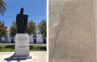
Figure 54.63: Lisboa, a statue of King
Manuel I: Pela Graça de Deus, Rei de
Portugal e dos Algarves, d’ Aquém e d’
Além-Mar em África, Senhor da Guiné e
da Conquista, Navegação e Comércio da
Etiópia, Arábia, Pérsia e Índia, etc. (For
the Grace of God, King of Portugal and
the Algarves, of Aquém and Além-Mar in
Africa, Lord of Guinea and the Conquest,
Navigation and Commerce of Ethiopia,
Arabia, Persia, and India (Courtesy of F.
Vanhecke, 2019). Furthermore, the grave
inside the Saint Augustin Church (estab-
lished in 1602) of Goa Velha, of Francisco
de Almeida, 1629. (Goa, 2019) (Declercq
de Silva Archive)
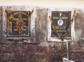
Figure 54.64: Modern graves of da Silva and Almeida were found in
Goa. (Goa, 2019) (Declercq de Silva Archive)
hatuncuraca Gonzalo Taulichusco. Murmurs and interdictions hindered the implementation of his new directives.
In 1564, Silva composed a letter directed towards the King, wherein he presented recommendations for the effective governance of Peru. His acquaintance, the Dominican Archbishop Jerónimo de Loayza, commissioned and endorsed this correspondence. Viceroy Toledo appointed Silva as the overseer of Jauja and Huamanga. On July 1, 1572, Silva established the settlement that now encompasses the urban center known as Huancayo, which served as a precursor to the present-day metropolis. During a visit, he tragically succumbed to a fatal accident by falling into a ravine at Huamanga on March 17, 1574. His mortal remains were interred inside a chapel on his estate, specifically within the confines of the Convent of San Francisco de Lima.
Jerónimo de Silva’s contributions to the colonial history of Peru are significant. His role in founding Huancayo, involvement in political and military affairs, and defense of the encomendero class highlight his influence in the Spanish conquest and colonization efforts. Silva’s life was a microcosm of the broader conflicts and transformations that defined early colonial Peru, illustrating the interplay between ambition, loyalty, and power in the New World.
Silva’s legacy exposes a turbulent history of Spanish colonization in South America.
54.9.3 Other de Silvas in Sri Lanka
For Sri Lanka and the persons in India immediately involved in its conquest, we may refer to the books of which narratives are rephrased further, specifically to O. M. da Silva Cosme’s work30. Note that O. M. da Silva Cosme always writes the Portuguese version of the names involved.
They include Pinto da Silva, Manuel Jorge da Silva, Ernesto da Silva, da Silva Correia, Alberto Carlos Germano da Silva Correia, Dona Clara da Silva, Bento da Silva, Jao da Silva Tello, Antonio da Silva, Pedro da Silva, Pedro da Silva Molle, Jornado Vincente da Silva, Vincente da Silva, Gomes da Silva, Pero Peixto da Silva, Salvador Pereyra da Silva, Francisco Macedo da Silva, Salvador da Silva, Luis Corea da Silva, Duarte da Silva, Duarte Peyxoto da Silva, Francisco da Silva, Francisco da Silva Castelhano, Diogo da Silva, and Pero da Silva.
54.10 The Particular Connection between Shirani de Silva, Francisco de Almeida
and Lorenzo de Almeida
Francisco de Almeida, the first Viceroy of India, is intricately connected to the de Silva family through Don Aires Gomez de Silva.
The Casa de Silva chronicles detail this connection, notably through Don Fernando II, Duke of Braga, who fathered Don Fernando III and Don Alvaro with Duchess Dona Juana de Castro. Don Fernando III married Dona Isabel, daughter of King Don Manuel (as illustrated in Figure 54.63), while Don Alvaro wed Dona Felipa de Melo.
Dona Felipa de Melo (d. 1516) was the daughter of Lord Rodrigo Alfonso de Melo (1430-1487) and Dame Dona Isabel de Meneses, herself the daughter of Don Aires Gomez de Silva and Brites de Meneses. Dona Felipa’s eldest son, Don Rodrigo de Melo I (1468-1545), Marquis of...etc., married Dona Leonor de Almeida (b. 1470).
Dona Leonor de Almeida was the daughter of Francisco de Almeida, the first Viceroy of India, and Dona Juana Pereira. Francisco de Almeida was the son of Don Lope de Almeida and Dame Dina Beatriz de Silva, the latter being the daughter of Pere Gonzalez de Malasaya and Isabel Gomez de Silva (daughter of Juan Gomez de Silva and Margarita Coelho).
The aforementioned Don Aires Gomez de Silva (husband to Brites de Meneses) was the son of Juan Gomez de Silva (d. 1445) and Margarita Coelho. Juan Gomez de Silva was the son of Gonzalo Gomez de Silva (d. 1386) and Leonor Gonzales de Fonseca; he had two brothers, Diogo Gomez de Silva and Fernao de Silva. Gonzalo Gomez de Silva was a son of Juan Gomes de Silva and Constanza Gil de Joida. Before marrying Constanza, Juan Gomes de Silva was married to Senhorinha Alvares Redondo. Their eldest son, Aires Gomez (el Mozo) de Silva (1320-1365 or 1315-1385, depending on the source), married thrice, with his second marriage to Urraca Mendes Tenoria (b. 1332). Aires Gomez de Silva is an ancestor of Shirani de Silva, as detailed in Chapter 54.5.18.
30O. M. da Silva Cosme, ’Fidalgos in the Kingdom of Kotte (Sri Lanka: 1505 - 1656), The Portuguese in Sri Lanka,’ Limited edition of 350 copies, copy no. 31 and signed by the author, published in Colombo, Sri Lanka, in 1990, by Harwoods Publishers, 38 1/1/, Dudley Senanayake Mawatha, Colombo 8, and printed by Evangel Press Limited, 490/8 Havelock Road, Colombo 6, Sri Lanka.
The Desclergues of la Villa Ducal de Montblanc, 2nd ed., Omn., VOL. IV
© 2024 Nico F. Declercq
1082
CHAPTER 54. RECENT FAMILY HISTORY OF SHIRANI DE SILVA
Figure 54.65:
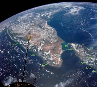
Places of historical in-
terest in the context of this book, viewed
from the International Space Station: Goa
(GOA), Calicut (CAL), Cochin (COK),
Galle (GAL), Kalutara (KAL), Uduwara
(UDU), Colombo (COL), Kotte (SJP),
Manar (MAN), Jaffna (JAF), Trinco-
malee (TRI), Batticaloa (BAT), Kandy
(KAN). (Courtesy of NASA)
Figure 54.66: When one lands or takes off at Singapore’s Changi Air-
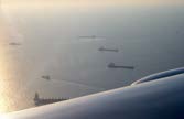
port, the sight of the bustling harbor and the adjacent Malacca Strait
is impressive and telling. Singapore’s strategic maritime location has
enabled it to eclipse nearby Malacca in terms of economic and logistical
significance. Despite being a mere 120 kilometers apart, the disparity
in development and infrastructure between the two ports is stark. Sin-
gapore boasts state-of-the-art facilities, unparalleled accessibility, and a
favorable fiscal environment, positioning it as a premier global maritime
hub. This contrast underscores Singapore’s ascendancy in regional and
international trade networks. The author took a photograph accompa-
nying this observation during a visit to Singapore in 2010, capturing a
moment of reflection on the evolution of maritime commerce in South-
east Asia. However, it is essential to acknowledge that Malacca, while
no longer the dominant port it once was, continues to operate and
retains a measure of regional importance. Its historical legacy and on-
going role in maritime activities provide a nuanced perspective on the
dynamic shifts within global trade routes. (Declercq de Silva Archive)
Thus, Francisco de Almeida and his son Lorenzo de Almeida share a double bloodline connection to the de Silva family. Francisco de Almeida, also known as the Great Dom Francisco, was born in Lisbon around 1450 and died in 1510 at Table Bay, Cape of Good Hope. He was a Portuguese nobleman, soldier, and explorer. Before his tenure in India, he distinguished himself as a counselor to King Juan II of Portugal in the Conquest of Granada in 1492 and battles against the Moors. In 1505, he became the first governor and viceroy of the Portuguese State of India (Estado da Índia), establishing Portuguese dominance in the Indian Ocean.
His son, Lorenzo de Almeida, was also notable. Lorenzo extended Portuguese influence to Ceilao (Sri Lanka), exploring the coasts south of Colombo (Kalutara or Caltura near Uduwara) and establishing settlements. His first voyage to Ceilao was in 1505. Lorenzo died in 1508 in Chaul (India) at 28. After Lorenzo’s death, Alfonso de Albuquerque (born 1509 in Alhandra, Portugal - dead 1515
in Goa, India) arrived at Cannanore (Kannur, India) in 1508 and succeeded Francisco de Almeida as Viceroy. Francisco de Almeida resisted initially, driven by a desire to avenge his son’s death.
Francisco de Almeida’s siblings included Joao de Almeida, Diogo Fernandes de Almeida, Jorge de Almeida, Pedro de Almeida, Fernando de Almeida, Isabel de Silva, and Branca de Almeida. Francisco married twice, first to Brites Pereira and then Joanna Pereira, fathering two sons named Lorenzo de Almeida. It is speculated that one son died young, prompting the naming of a subsequent son with the same name. This second son is the one noted for his ventures in Sri Lanka. It is possible that Diogo de Almeida served as an emissary for Lorenzo de Almeida during his visit to Sri Lanka.
The tombs of de Almeida and da Silva in Goa are depicted in Figures 54.63 and 54.64.
54.11 Early Presence of de Silvas in Sri Lanka
For readers unfamiliar with the Indian subcontinent, we present a satellite photo in Figure 54.65 to provide geographical context.
In M. G. Francis’s book,31, the de Silvas first appear early in the Portuguese period of the island.
Historical evidence shows that while they never played the most prominent roles in the country, they were involved in trade, religion, and, to some extent, military affairs. However, a few notable exceptions are documented in the following texts and narratives.
Notably, Antonio Carvalho de Silva, Shirani de Silva’s paternal ancestor, played a significant role in fortifying Portuguese territories with Samara de Cunha y Rala (also known as Samarakoon), particularly constructing a stone fortress at Uduwara.
Chapter 11 of Francis’s book is dedicated to the events involving Donna Catherina, a Singhalese princess. It documents that Don Francisco de Silva was the military commander of Colombo in 1587, typically leading military interventions. However, a nobleman passing through Sri Lanka from Malacca to Goa, Don Pere Lopez de Sousa, assumed control due to his higher noble rank and a more significant number of soldiers, leading to Don Francisco de Silva’s disapproval.
Several other de Silvas are mentioned in various capacities.
Don Juan de Silva, Don Edouardo de Silva, and Emmanuel de Silva were priests. Dom Diogo de Silva, a priest, was ordered to 31M. G. Francis, ’History of Ceylon, an abridged translation of Prof. Peter Courtenay’s work,’ Mangalore, Printed at the Codialbail Press, 1913, ISBN
81-206-1406-2.
© 2024 Nico F. Declercq
The Desclergues of la Villa Ducal de Montblanc, 2nd ed., Omn., VOL. IV
54.11. EARLY PRESENCE OF DE SILVAS IN SRI LANKA
1083
defend Colombo’s fortress around 1630, despite not being a military man, as he was the only suitable option available.
The Viceroy Joan de Silva Tellez de Menezes, Count of Aveiras, landed at Goa in September 1640 with the duty of organizing further defense of Sri Lanka against the Dutch. Additionally, Salvador Pereira de Silva, a Portuguese military commander, was stationed at the fortress of Corvite (Kuruvita) in 1596, which is located between Uduwara and Adam’s Peak, 50 km east of Horana.
O. M. da Silva Cosme32 references numerous de Silvas and Carvalhos.
For instance, a certain Carvalho was the factor of Colombo in 1546. Luis de Carvalho, a cousin of Fernando Samara de Cunha y Rala, was blood-related to Antonio Carvalho de Silva, Shirani’s ancestor, explaining the DNA trace to Aquitaine in France, likely through the Kingdom of Navarre.
Both Francis and Da Silva Cosme mention that around 1598, Salvador Pereyra de Silva became de Acevedo’s captain-major of the army, alongside Gaspar Correa, tasked with establishing camps on the frontiers.
Fernando Samara de Cunha y Rala was in Matara, overseeing the south, while Lourenço Perez de Carvalho was responsible for Galle, facing the prince of Uva.
In April 1600, reinforcements from Goa arrived, and Azevedo requested Antonio de Silva (Antonio Carvalho de Silva) and Samara de Cunha y Rala to open new frontlines on Uva’s frontiers.
Salvador Pereira de Silva also conducted counter-attacks on the Kandyans. Simao Correa escaped to Kandy by bribing a lascarin, receiving the name Navaratne Bandara, and was eventually captured by Salvador Pereyra de Silva. Salvador continued successful campaigns, subduing Sabaragamuwa, but was eventually trapped in Kuruvita Temple, which he later escaped.
In August 1611, the Kandyans were attacked again by an army of lascarins and around 700 Portuguese, many from Goa. The campaign included the dissawas of Matara and the Seven Korales, Domingos Carvalho Cam, Luis Gomes Pinto, and Luis Cabral de Faria.
Domingos Carvalho Cam became captain of Balana, in Chapter 56, with 250 Portuguese soldiers and 1000 lascarins. Azevedo then rushed to Colombo, where Senarat was approaching with soldiers to conquer the city. Carvalho Cam thwarted Senarat with a surprise attack, causing the Kandyans to flee.
According to Azevedo, Goa did not adequately supply Carvalho Cam, which focused on Malacca, besieged by the VOC in 1606 and embroiled in the Achin war. Malacca then held strategic importance comparable to modern-day Singapore, as illustrated in Figure
Fernando Samara de Cunha y Rala successfully fought at Orutota and Alutkuru Korale.
Aritta Kivendu Perumal, the Sitawaka army commander, repelled a combined force of lascarins and Portuguese.
The commander in chief of the Kotte army, Diogo de Silva, was killed in battle, while the Portuguese commander Francisco de Silva Castelhano narrowly escaped. In some instances, Francisco de Silva Castelhano was kidnapped and then released. There is also a reference to ’De Souza’ joining forces at the foot of Kandy with Francisco de Silva Arcalaos.
Da Silva Cosme describes that the Portuguese preferred Dona Catherina to become the Queen of Kandy over the young King Dom Joao. They intended for her to marry a Portuguese, making him the King of Kandy.
Queiroz wrote that the groom was Francisco de Silva, Portuguese India’s most handsome young man. However, Francisco returned to Manar before the final battle and drowned when his ship sank on the way back to India.
Another candidate to marry Dona Catherina was Jayavira’s cousin. Later, Domingos Correa and Francisco de Silva were appointed to control the Seven Korales, while Samara de Cunha y Rala was allocated Rayigam Korale. At Bocolagama, mudaliyar Attapatu took up arms against Correa but was defeated. Consequently, Correa, along with Duarte Peyxota de Silva, swiftly conquered Denavaka.
In 1589, Samara de Cunha y Rala, or Samarakoon, and Duarto Peyxoto de Silva were sent to Denawaka to resist the Portuguese.
However, they diverted to Menikkadawara, where the captain-general resided.
In 1583, notable figures such as Friar Duarte de Silva and Luis Corea de Silva were mentioned.
Sitawaka was besieged at some point, and on March 23, 1603, captain-major Pereira de Silva saved Sitawaka with 11 Portuguese companies and 200 lascarins.
Around April 15, 1603, Captain Francisco Maçedo de Silva surrendered the fortress of Talampitiya to 10000 Kandyan troops, as the situation had become untenable.
32O. M. da Silva Cosme, ’Fidalgos in the Kingdom of Kotte (Sri Lanka: 1505 - 1656), The Portuguese in Sri Lanka,’ Limited edition of 350 copies, copy no. 31 and signed by the author, published in Colombo, Sri Lanka, in 1990, by Harwoods Publishers, 38 1/1/, Dudley Senanayake Mawatha, Colombo 8, and printed by Evangel Press Limited, 490/8 Havelock Road, Colombo 6, Sri Lanka.
The Desclergues of la Villa Ducal de Montblanc, 2nd ed., Omn., VOL. IV
© 2024 Nico F. Declercq
CHAPTER 54. RECENT FAMILY HISTORY OF SHIRANI DE SILVA
© 2024 Nico F. Declercq
The Desclergues of la Villa Ducal de Montblanc, 2nd ed., Omn., VOL. IV
Chapter 55
The Appearance of the Portuguese and the
Establishment of the Portuguese Kingdom of Kotte
55.1 Introduction
Figure 55.1: This translation to Singhalese is the courtesy of Thushani Dissanayake.
When the Portuguese finally discovered a route around Africa, circumventing the intermediary Muslim traders who obstructed their access to Asia, new opportunities emerged for India, Sri Lanka, and, naturally, Portugal.
It is important to note that Sri Lanka was not a unified country but an island comprising several kingdoms. The most prominent was the Kingdom of Kotte, located along the southwestern coast. This kingdom eventually allied with the Portuguese, who, over time, integrated it into their empire through feudal inheritance.
The author explores the genetic, historical, and cultural connections between the Sri Lankans and the Portuguese. It is important to acknowledge that some of the facts presented are controversial, especially given the rise of nationalism in Sri Lanka and the impact of the civil war, which has prompted a reevaluation of the nation’s history. The historiographical approach to Sri Lanka’s past has significantly changed since the Portuguese era and over the past century. A notable example of this is the work of Chandra R. de Silva, whose study on this evolution is highly recommended by the author. ootnote Chandra R. de Silva, "Portugal and Sri Lanka: Recent Trends in Historiography", in Re-exploring the Links: History and Constructed Histories between Portugal and Sri Lanka, ed. Jorge Flores, Wiesbaden: Harrassowitz Verlag, 2007, pp. 3-26.
55.2 The Rulers of Kotte and Successors of Interest
Our journey into the world of 16th-century Sri Lanka, the world that the Portuguese encountered, begins with a brief overview of the rulers of that period. This period is significant as it marks the arrival of the Portuguese, a pivotal event in Sri Lankan history.
The Desclergues of la Villa Ducal de Montblanc, 2nd ed., Omn., VOL. IV
© 2024 Nico F. Declercq
CHAPTER 55. THE APPEARANCE OF THE PORTUGUESE AND THE ESTABLISHMENT OF THE
1086
PORTUGUESE KINGDOM OF KOTTE
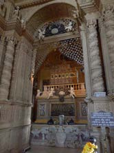
Figure 55.2: Relics of Francis Xavier at the Basilica of Bom Jesus
(1594). (Goa, 2019) (Declercq de Silva Archive)
Figure 55.3: It’s practically certain that no VOC men have visited the Imperial Palace
in Kyoto, as shown in this image. The Imperial Palace moved from Kyoto to Tokyo in
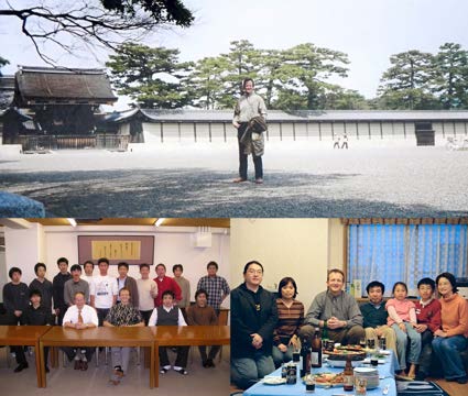
1869 during the Meiji Restoration. The author has warm memories of Japan. We see a
picture taken during one of his visits to Professor Sadayuki Ueha’s laboratory at the Tokyo
Institute of Technology in 2004. The author spent more than a month in Tokyo in 2006.
The other picture was taken that year at Professor Kentaro Nakamura’s home. (Declercq
de Silva Archive)
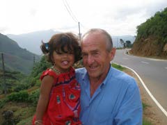
Figure 55.4: 2007, Maurice Declercq and Anna-Laura
were in the hilly country of the Kingdom of Kandy, be-
tween the city and Nuwara Eliya, in Sri Lanka. (Declercq
de Silva Archive)
© 2024 Nico F. Declercq
The Desclergues of la Villa Ducal de Montblanc, 2nd ed., Omn., VOL. IV
55.2. THE RULERS OF KOTTE AND SUCCESSORS OF INTEREST
1087
Sri Lanka was a beautiful island that consisted of different kingdoms and principalities. Indeed, the Kingdom of Kotte was the largest on the island and was what the Portuguese would call Ceilao. People of Kotte probably spoke Singhala when the Portuguese arrived, and most were Buddhist. The second-largest kingdom was Kandy, which mainly consisted of the hill country. The Kandyans were also predominantly Buddhist and spoke Sinhalese.
There was also the Jaffna Kingdom. Although it played an essential role for the Portuguese, it did not notably influence the relationship between the Portuguese and the Kotte Kingdom. Therefore, we shall not focus on Jaffna, the Northern Kingdom, which the Portuguese called Yalapalan, Yapane or Jaffnapatam. The population there mostly spoke Tamil, and their religion was mainly Hindu.
The traditional caste system further subdivided the three kingdoms, while ’language’ did not necessarily equate to ’race.’
Numerous historical works substantiate the extensive migrations from India throughout history and within Sri Lanka, highlighting that people often adopted the local language upon relocation.
The Kings of Kotte, descendants of the ancient rulers of Polonnaruwa and Anuradhapura, were also referred to as Chakravarti, or emperors of Sri Lanka.
The northern boundary of Kotte extended beyond Puttalam, reaching south to Pomparippu, while the Four Korales lay to the north of Kotte, positioned between the Northern Kingdom and its border.
The West acknowledged the existence of Sri Lanka even before the Portuguese discovery. Archaeological evidence attests to the contact between Sri Lanka and the Romans.1.
55.2.1 Dharma Parakramabahu IX of Kotte
He reigned from 1508 until 1528 and was the son of Vira Parakramabahu VIII. The latter is also known as Ambulagala Kumara.
55.2.2 Vijayabahu of Kotte
Vijayabahu of Kotte, a significant figure in the history of Sri Lanka, assumed the throne following the demise of his brother, Parakramabahu IX of Kotte. His reign, which spanned from 1513 to 1521, was a crucial period in the kingdom’s history.
Despite the people’s inclination towards his half-brother Sakalakala Valla, it was Vijayabahu who was crowned king in 1513, thereby averting any immediate dispute over succession.
Vijayabahu’s reign and family dynamics significantly impacted the subsequent history of the Kingdom of Kotte.
He had two wives: his first wife, Anula Kahatuda, bore him three sons—Bhuvanekabahu, Mayadunne, and Maha Raigam Bandara.
His second wife, a queen from Kiravella, gave birth to Deva Rajasinghe.
Influenced by his second queen, Vijayabahu intended to place her son on the throne after his death. This plan involved the assassination of his three sons from his first marriage, a scheme that was never realized and ultimately led to a turbulent period for the kingdom.
The three sons of Vijayabahu played pivotal roles in the kingdom’s future. They orchestrated the infamous event known as the Vijayabahu kollaya (the spoiling of Vijayabahu).
King Jaya Vira II of Kandy, who had married Mayadunne’s cousin, provided sanctuary and military support to the three brothers, enabling them to retaliate against their father. Although the kingdom teetered on the brink of war, the people of Kotte were unwilling to engage in conflict against either their king or the princes. Instead, personal retaliations ensued, culminating in Vijayabahu’s assassination by a Muslim named Salman, hired by the Sinhalese, who were bound by custom not to kill their king with their own hands.
Following Vijayabahu’s demise, the Kingdom of Kotte was divided into three parts, marking a significant shift in the kingdom’s power dynamics.
The eldest son, Bhuvanekabahu, retained the largest portion and continued to rule a diminished Kotte as King Bhuvanekabahu VII.
His brothers, Mayadunne and Raigam Bandara assumed Sitawaka and Raigama’s thrones, respectively.
After Raigam Bandara’s death, Mayadunne seized control of Raigama, ruling both Sitawaka and Raigama, and directly challenging his brother Bhuvanekabahu’s authority over Kotte. There are speculations that Mayadunne may have played a covert role in the assassination of their father, King Vijayabahu of Kotte.
This period of Sri Lankan history is marked by intense familial strife, political intrigue, and shifting allegiances.
55.2.3 Bhuvanaikabahu VII of Kotte
Bhuvanaikabahu VII of Kotte, born in 1468, was a pivotal figure in Sri Lanka’s history. He reigned from 1521 until his assassination in 1551. He was the son of King Vijayabahu of Kotte and Anula Kahatuda.
His reign was marked by intense political and military struggles, particularly with his brothers Mayadunne, who became the King of Sitawaka, and Rayigam Bandara, who ruled Raigama.
Upon the death of Rayigam Bandara, Mayadunne annexed his kingdom and persistently contested Bhuvanaikabahu VII’s rule over Kotte. This period was characterized by ongoing conflicts between Bhuvanaikabahu VII and Mayadunne, often involving Mayadunne’s son, Rajasinghe I.
These internal conflicts were exacerbated by external pressures, most notably from the Portuguese, with whom Bhuvanaikabahu VII eventually allied to protect his kingdom. The alliance was a strategic move against Mayadunne and Rajasinghe I and a defense against external threats such as the Zamorin of Calicut and his alliance with the Moors.
In the mid-16th century, Bhuvanaikabahu VII had a significant encounter with Francis Xavier, shown in Figure 55.2, the renowned Jesuit missionary. This meeting revealed Bhuvanaikabahu’s personal interest in Christianity, a complex dynamic in a kingdom with diverse religious beliefs.
He sought Portuguese protection without the necessity of converting, a request that underscores the intricate interplay between politics and religion in his reign. Despite the efforts of Francis Xavier and Antonio Barreto, the King remained unconverted.
The end of Bhuvanaikabahu VII’s reign was a tragic one, marked by his assassination on December 29, 1550. While some historians suggest that the Portuguese were responsible for his murder, the more plausible theory implicates his brother Mayadunne, who was driven by a desire to claim the throne of Kotte.
The King left no male heir; however, his daughter Samudra Devi had a son, who ascended to the throne at a young age, continuing the lineage of the Kotte dynasty.
1The author has not studied this evidence.
The Desclergues of la Villa Ducal de Montblanc, 2nd ed., Omn., VOL. IV
© 2024 Nico F. Declercq
CHAPTER 55. THE APPEARANCE OF THE PORTUGUESE AND THE ESTABLISHMENT OF THE
1088
PORTUGUESE KINGDOM OF KOTTE
Bhuvanaikabahu VII’s reign is a testament to the turbulent period in Sri Lankan history marked by fraternal rivalry, strategic alliances with European powers, and cultural and religious complexities. His interactions with significant figures such as Francis Xavier highlight the broader global context within which these local struggles took place.
55.2.4 Dom Joao Dharmapala Peria Bandara of Kotte
Dom Joao Dharmapala Peria Bandara of Kotte, the grandson of Bhuvanaikabahu VII of Kotte, succeeded his grandfather as the last King of Kotte. Born Dharmapala Bandara, he adopted the Portuguese first name Joao upon his baptism, signifying his conversion to Christianity. This conversion was not solely religious but also a strategic act of subjugation to the Portuguese to secure his kingdom.
The Portuguese played a pivotal role in the Kingdom of Kotte, providing crucial protection against external threats from Mayadunne and the Zamorin of Calicut. Their significance extended beyond military alliances, as they were instrumental in ensuring the economic security of Kotte within the intricate commercial networks of Southeast Asia. The alliance with the Portuguese was therefore not just a matter of stability, but also a key factor in the kingdom’s economic prosperity during a turbulent period.
Joao Dharmapala’s reign came to a definitive end with his death on May 27, 1597, at the Portuguese Fort of Colombo, located within his Kingdom of Kotte. His marriages to Dona Catherina, Dona Margarida, and Dona Isabel were significant alliances. However, his demise marked a profound shift in the political landscape, as the independent Kingdom of Kotte was no more. It was now known as Portuguese Kotte, Portuguese Ceylon, or simply Ceilao. The vacuum left by his death was filled by the emergence of the de Silva family, who would go on to play a significant role in the history of Sri Lanka.
This transition period was characterized by significant changes in Sri Lanka’s political and cultural landscape. The Portuguese’s influence extended beyond mere military and economic aspects, as they also left a lasting impact on the island’s social and religious fabric. The end of Joao Dharmapala’s reign and the subsequent integration of Kotte into the Portuguese colonial empire signify a critical juncture in Sri Lankan history, marking the beginning of a new era of foreign dominance that would shape the island’s future for centuries to come.
55.2.5 Mayadunne of Sitawaka
Mayadunne of Sitawaka was the brother of Bhuvanaikabahu VII of Kotte. He held the title of King of Sitawaka and later of Raigama.
His legacy is critical to understanding the resistance against colonial powers, as he and his descendants posed a persistent threat to the Portuguese and later the Dutch East India Company (VOC). Although Mayadunne never reigned over Kotte, his influence and actions mark him as a prominent figure in Sri Lankan history.
During the rise of Sinhalese nationalism, a period characterized by intense efforts among the Sinhalese to assert their cultural and political identity, Mayadunne was celebrated as a hero for his defiance against the Portuguese. This era saw every Sinhalese striving to be more ardently patriotic than their neighbors, and Mayadunne’s opposition to foreign domination earned him admiration and respect.
Geographically, Raigama corresponds to the present-day Southern Province and the Kalutara District, excluding its coastline, with Uduwara marking its boundary.
Sitawaka, now known as Avissawella, encompassed what is currently the Sabaragamuwa Province, specifically the Kegalle and Ratnapura districts.
A pivotal event in Mayadunne’s reign was the smuggling of the Sacred Tooth Relic of Buddha from Kotte to Sitawaka by Buddhist monks. This act was driven by the belief that the relic would be safer with Mayadunne, who opposed the Portuguese, rather than in Kotte, which had become a vassal state under Christian Portuguese rule. According to Sri Lankan traditions, the kingdom in possession of the Sacred Tooth Relic held supremacy over other kingdoms on the island, thus asserting its dominance.
One of the significant military engagements during Mayadunne’s time was the Battle of Mulleriyawa. This battle saw the forces of Mayadunne and his son Rajasinghe clash with the Portuguese army. The Portuguese suffered a decisive defeat, which curtailed their ambitions of conquering the entire island. This victory not only bolstered Mayadunne’s position but also marked a turning point in the resistance against Portuguese colonization efforts.
Mayadunne died in 1581 at the age of 80, leaving behind a legacy of resistance and national pride. His actions and the subsequent reverence for his defiance against foreign powers underscore his importance in Sri Lanka’s historical narrative.
55.2.6 Tikiri Bandara or Rajasingha I of Sitawaka
Tikiri Bandara, later known as Rajasingha I of Sitawaka, was a prominent figure in Sri Lankan history. Born as Tikiri Bandara, he earned the name Rajasingha (meaning ’King of Lions’) due to his bravery in the Battle of Mulleriyawa against the Portuguese.
His reign is subject to debate, with records suggesting it began in 1578, when his father Mayadunne transferred power to him, or in 1581, following Mayadunne’s death. Rajasingha I’s reign continued until 1592.
One significant aspect of Rajasingha I’s rule is the controversial and disputed account of him killing his father, Mayadunne. This alleged patricide reportedly caused friction with Buddhist leaders, as Rajasingha I purportedly opposed Buddhism after his father’s death. The rumor of this patricidal act was notably mentioned by Dutch traveler Joris van Spilbergen, who visited Sri Lanka later.
However, it remains uncertain whether Rajasingha I committed this act.
Rajasingha I’s conversion from Buddhism to Hinduism significantly shifted his policies and religious affiliations. He became an anti-Buddhist ruler, responsible for the destruction of numerous Buddhist religious sites and the establishment of Hindu temples, including at the sacred site of Sri Pada. His actions profoundly impacted the religious landscape of Sri Lanka during his reign.
Rajasingha I was also a formidable military leader and strategist. In 1582, he successfully annexed the Kingdom of Kandy to the Kingdom of Sitawaka. Earlier, in 1565, he had annexed the northern regions of Kotte. By 1587, his kingdom had expanded to include the coastal area around Matara in the south, the region just east of the town of Kotte, and the coastal areas between Negombo and Kalpitiya. Consequently, the Kingdom of Kotte, later Portuguese Ceylon, was reduced to a narrow coastal strip approximately 50 kilometers wide, stretching from Negombo to Galle, along with the Kalpitiya peninsula.
Rajasingha I’s reign was marked by territorial expansion and significant religious and cultural shifts, leaving a lasting legacy on Sri Lanka’s history.
© 2024 Nico F. Declercq
The Desclergues of la Villa Ducal de Montblanc, 2nd ed., Omn., VOL. IV
55.2. THE RULERS OF KOTTE AND SUCCESSORS OF INTEREST
1089
55.2.7 Vimaladharmasuriya I of Kandy and Nikapitiya Bandara of Sitawaka, a.k.a. Dom Felipe
55.2.7.1 Vimaladharmasuriya I of Kandy
Tikiri Bandara was the king of a vast kingdom that encompassed almost the entire island of Sri Lanka, except for the north and the narrow strip along the southwest coast known as the Kingdom of Kotte. Upon his death in 1592, he was succeeded by Vimaladharmasuriya I of Kandy.
Vimaladharmasuriya I reigned from 1592 until 1604 and was succeeded by Senarat of Kandy. He was married to Kusumasana Devi.
The lineage and reasons for Vimaladharmasuriya I’s succession are unclear. Some historical sources suggest that his father was a Kandyan chieftain named Virasundara Mudiyanse of Peradeniya.
Vimaladharmasuriya I had several pseudonyms, including Konappu Bandara, Don Joao of Austria (after being baptized in Goa following his escape from Sri Lanka during Tikiri Bandara’s invasion of Kandy), and Don Juan Appuhamy. These names suggest a complex history, possibly referring to different periods in his life or even different individuals. It is generally accepted that his mother was Kosbokke Gedara Vimalu, after whom he took the name Vimaladharmasuriya.
Known to the Portuguese as Dom Joao of Austria, Vimaladharmasuriya I married Dona Catherina in 1594. This marriage was supported by the Portuguese, who presented him as the legitimate successor to the Kandyan throne. After renouncing Christianity and converting to Buddhism, he constructed a shrine for the Sacred Tooth Relic in Kandy, in Figure 51.2. This act was significant as it established Kandy, where his palace was, as the capital of all kingdoms in Sri Lanka.
Vimaladharmasuriya I’s reign saw significant interactions with foreign powers. He allied with the Dutch through Joris van Spilbergen to combat the Portuguese. This alliance, mediated by Sebald de Weert and Admiral Wybrand van Warwijck, ultimately failed due to cultural misunderstandings and insults, resulting in the death of de Weert and 47 Dutchmen. However, a more successful alliance was formed in 1612 between the VOC (Dutch East India Company) and the Kingdom of Kandy, established by Marcellus de Boschouwer with Senarat of Kandy, Vimaladharmasuriya I’s successor.
Vimaladharmasuriya I played a crucial role in the revival of Buddhism in Sri Lanka. His predecessor, Tikiri Bandara, had nearly eradicated Buddhism on the island. Vimaladharmasuriya I’s conversion to Buddhism led him to import monks from Lower Burma to revitalize the religion. He also moved the Sacred Tooth Relic to Kandy from its previous hiding place at Delgamuwa Raja Maha Vihara in the Sabaragamuwa Province, solidifying Kandy’s status as a religious center.
The Dutch, who had established a settlement in Japan since 1609, were well-known for their trade relations rather than religious missions. This settlement, initially located in Hirado on Kyushu and later moved to Nagasaki in 1641, facilitated trade between Europe and Asia. The Japanese tolerated the VOC due to their lack of religious agendas and their role in providing valuable information and trade goods. Despite the limited cultural exchange, the Dutch presence in Japan marked a significant period of interaction between the East and West. The author stayed several times in Japan, as illustrated in Figures 55.3.
In summary, Vimaladharmasuriya I of Kandy was a pivotal figure in Sri Lanka’s history. His reign marked a period of religious revival, strategic alliances, and significant political maneuvers that shaped the island’s future. His efforts to restore Buddhism and establish Kandy as a central kingdom had lasting impacts still evident in Sri Lanka today.
55.2.7.2 Nikapitiya Bandara of Sitawaka
In the late 16th century, the political landscape of Sri Lanka was marked by significant upheaval and power struggles. Following the death of King Rajasinghe I, the Kingdom of Kandy saw the ascension of Vimaladharmasuriya I. Concurrently, Nikapitiya Bandara rose to power as the King of Sitawaka. His reign, however, was short-lived and tumultuous. Nikapitiya Bandara’s military commander, Aritta Kivendu Perumal, played a pivotal role in the kingdom’s military and political affairs. Originating from Waddakuru in India, Aritta Kivendu Perumal brought a wealth of experience and a strategic mindset. His role extended beyond military command as he also served as the regent, leveraging his influence in the kingdom’s governance.
The involvement of Maha Biso Bandara, the sister of the late King Rajasinghe I and the widow of Vidiya Bandara, further consolidated the regency. Maha Biso Bandara’s political acumen and familial connections provided a semblance of stability in the otherwise volatile political environment of Sitawaka.
However, the stability of Sitawaka was soon threatened by external forces. The Kingdom of Kotte, emboldened by internal strife within Sitawaka, launched a series of campaigns to annex the territory. The ensuing conflict saw the gradual erosion of Sitawaka’s power.
Amidst these turbulent times, Aritta Kivendu Perumal, capitalizing on the chaos, orchestrated a coup against Nikapitiya Bandara.
Seizing the throne, Aritta Kivendu Perumal adopted the royal title of King Jayavira Bandara, thereby consolidating his authority over Sitawaka.
However, Nikapitiya Bandara’s fate took a dramatic turn following his overthrow. Captured by the Portuguese, he was taken to Colombo, where he underwent baptism and received the Christian name Dom Felipe.
Recognizing the potential of leveraging him as a political pawn, the Portuguese sent him to Goa for further education. His journey continued to Portugal, where he was poised to enter the University of Coimbra, a prestigious institution known for its academic rigor.
Tragically, Nikapitiya Bandara’s life was cut short when he died in 1608, just as he was on the cusp of beginning his educational pursuits.
The stories of Nikapitiya Bandara and Aritta Kivendu Perumal are testaments to the complex and often turbulent nature of monarchical successions and the impact of foreign interventions on shaping the region’s historical trajectory.
55.2.8 Senarat of Kandy
Senarat of Kandy was a pivotal figure in Sri Lanka’s history, particularly during the early 17th century. He ruled the Kingdom of Kandy, in Figure 55.4, from 1604 until he died in 1635. Succeeding Vimaladharmasuriya I, Senarat’s reign was a transitional period marked by internal consolidation and external conflict, notably with the Portuguese.
Senarat was married to Dona Catherina, the widow of Vimaladharmasuriya I, which strengthened his claim to the throne. His other marriages to Suriya Devi and Sama Devi, both daughters of the former king and Dona Catherina, further solidified his political alliances within the royal family. These strategic marriages ensured a continuity of power and stability within the Kandyan court.
Senarat’s rule was challenged by ongoing conflicts with the Portuguese, who were intent on expanding their control over Sri Lanka.
During his reign, the Portuguese managed to reconquer significant territories from Kandy, showcasing the persistent threat they posed. Senarat was not renowned for his military prowess, unlike some of his predecessors and successors. His reign is often characterized by the strategic, albeit sometimes passive, resistance to Portuguese advances rather than outright military victories.
Despite these challenges, Senarat maintained his rule until he died in 1635. He was succeeded by his son, Rajasinghe II of Kandy, The Desclergues of la Villa Ducal de Montblanc, 2nd ed., Omn., VOL. IV
© 2024 Nico F. Declercq
CHAPTER 55. THE APPEARANCE OF THE PORTUGUESE AND THE ESTABLISHMENT OF THE
1090
PORTUGUESE KINGDOM OF KOTTE
who would later play a more aggressive role in resisting Portuguese influence. Senarat had other children, including Vijayapala and Kumarasinghe, who also held significant positions within the kingdom.
It is speculated that Senarat might have been a cousin of Vimaladharmasuriya I, which would explain his ascension to the throne following Vimaladharmasuriya I’s death. This familial connection would have provided his rule an additional layer of legitimacy.
Senarat of Kandy’s leadership, though not marked by military victories, played a crucial role in maintaining the sovereignty of the Kingdom of Kandy during a tumultuous period in Sri Lankan history.
55.2.9 Rajasinha II of Kandy
Rajasinha II of Kandy was the son of King Senarat of Kandy and Dona Catherina of Kandy, the widow of King Vimaladharmasuriya I of Kandy.
His reign, which spanned from 1635 to 1687, was marked by political intrigue and shifting alliances against the backdrop of European colonial ambitions in Asia. His seat of power was located in Senkadagala, now known as the city of Kandy.
The period of Rajasinha II’s rule coincided with the rise of the Dutch East India Company (VOC) as a dominant power in Asia.
The Dutch, having established a stronghold in Batavia (modern-day Jakarta), sought to curtail the influence of Portuguese Goa.
This strategic goal aligned with the interests of the Kingdom of Kandy, leading to an alliance between the two entities against their common enemy, the Portuguese. In 1638, Rajasinha II signed an agreement with Adam Westerwolt of the VOC, marking the beginning of a collaborative effort to expel the Portuguese from Sri Lanka.
The alliance bore fruit with the capture of Batticaloa, the main port of the Kingdom of Kandy, in 1639. Following this, the Dutch, with Kandyan support, continued their military campaigns against the Portuguese, successfully seizing Galle in 1640. However, the geopolitical landscape in Europe influenced the course of events in Sri Lanka. The conclusion of the Eighty Years’ War in Europe created a complex dynamic as the VOC, now recognizing an opportunity to further their interests, contemplated collaboration with the Portuguese, who were at that time united with the Spanish crown.
The alliance between the Dutch and the Sinhalese was disrupted by 1638, leading to a protracted period of conflict between the Sri Lankans and the VOC. Despite this setback, a new coalition was formed between the Kandyans and the Dutch in 1649, though this, too, was fraught with duplicity. The Treaty of Münster in 1648, which formally recognized the Netherlands as an independent state, emboldened the VOC’s colonial ambitions. Their commitment to commercial dominance often led to treacherous actions, undermining their agreements with local powers.
Despite these betrayals, the Kandyans persisted in their efforts to drive out the Portuguese, relying on Dutch support. By 1656, the Dutch had achieved their objective, having ousted the Portuguese from their strongholds in Sri Lanka. However, once the Portuguese threat was eliminated, the Dutch reneged on their promises to the Kandyans, pushing them back to their highland territories without granting any territorial gains. This betrayal ignited further conflict, with the Kandyans now turning their resistance efforts towards the Dutch occupiers.
The narrative of Rajasinha II’s era is one of resilience and strategic maneuvering in the face of colonial exploitation.
The Kandyans’ continued resistance against foreign domination, first against the Portuguese and then against the Dutch, underscores the complexity of Sri Lanka’s colonial history. While this summary focuses on the interactions with the Dutch and the Portuguese, it sets the stage for subsequent chapters that delve into the arrival of the de Silva family and the construction of the Fortress of Uduwara, highlighting the intricate web of alliances and conflicts that shaped the region.
© 2024 Nico F. Declercq
The Desclergues of la Villa Ducal de Montblanc, 2nd ed., Omn., VOL. IV
The Strategic Strongholds of Balana, Thumpana, and
Deewalkanda
56.1 Introduction
To fully grasp the narrative explored in this book about Portuguese Ceylon and the role of Shirani’s ancestors, it is essential to provide some background on the strategic strongholds of Balana, Thumpana, and Deewalkanda.
The history of Sri Lanka during the Portuguese colonial period is marked by a series of fierce and strategic resistances led by the indigenous kingdoms. Among the various sites of conflict, Balana, Thumpana, and Deewalkanda stand out as significant battlegrounds where the determination and strategic understanding of the Sinhalese leaders were vividly demonstrated. Each location, with its unique geographical and strategic attributes, played pivotal roles in the resistance against Portuguese incursions and contributed to the broader struggle to preserve the island’s sovereignty and cultural heritage.
Balana, located within the Alagalla Mountain Range in the Central Province, served as a vital defensive outpost for the Kandyan Kingdom. Its formidable fortress and strategic positioning along the Kadugannawa Pass made it a key site for monitoring and controlling access to the kingdom. The battles fought here were characterized by the effective use of natural defenses, showcasing the military ingenuity of the Kandyan rulers.
Thumpana, situated within the rugged terrain of the Central Province, was another crucial site of resistance. The engagements at Thumpana highlighted the use of guerrilla tactics and strategic ambushes by the Sinhalese forces against the Portuguese. The region’s challenging topography provided a significant advantage to the local defenders, allowing them to mount a fierce resistance that contributed to the eventual decline of Portuguese power on the island.
Deewalkanda, a prominent rock formation in Uduwara along the Kalu Ganga, was a natural fortress for local leaders such as Fernando Samara de Cunha y Rala, better known as Samarakoon. The battles fought here exemplified the use of the local geography to orchestrate surprise attacks and defensive maneuvers. The resistance at Deewalkanda played a significant role in disrupting Portuguese supply lines and troop movements, further weakening their hold on the region.
The stories of Balana, Thumpana, and Deewalkanda provide a compelling narrative of resilience and strategic brilliance. These sites, each with unique challenges and tactical advantages, underscore the enduring spirit of resistance among the Sinhalese people.
This chapter delves into the historical significance of these battlegrounds, exploring the strategies employed, the battles fought, and the legacy left behind by the fierce defenders of Sri Lanka’s sovereignty.
56.2 Balana: A Strategic Outpost in the Alagalla Mountains
Balana, a village nestled in the Alagalla Mountain Range in Sri Lanka’s Central Province, holds significant historical importance due to its strategic location and its role in the defense of the Kandyan Kingdom. This village, located within the Kandy District, is renowned for its formidable Balana Fort, shown in Figure 56.1. It was a critical military outpost during the Portuguese period and subsequent colonial eras. The fortress, perched on the rocky terrain between the Kadugannawa Pass and the Alagalla Mountain Range, exemplifies the military ingenuity of the Kandyan Kingdom and its efforts to thwart foreign invasions.
56.2.1 The Strategic Importance of Balana Fort
The Balana Fort was constructed to serve as a defensive bulwark for the Kandyan Kingdom, particularly against the incursions of European colonial powers. During the Portuguese period, the fort’s strategic placement made it essential to the kingdom’s defense system. The Alagalla mountains provided a natural barrier, and the fort’s location offered a commanding view of the surrounding terrain, allowing the Kandyans to monitor and control access through the Kadugannawa Pass.
This region’s rugged topography and dense forest cover made it difficult for invading forces to navigate, providing the Kandyans with a significant tactical advantage. The fortifications at Balana were crucial in repelling Portuguese attempts to penetrate the heart of the Kandyan Kingdom. The fort’s robust construction and strategic location exemplify the era’s military architecture and strategic planning, reflecting the Kandyan rulers’ understanding of the terrain and using natural defenses to protect their sovereignty.
56.2.2 The Kadugannawa Pass: Gateway to the Kandyan Kingdom
The Kadugannawa Pass, located near Kadugannawa town in the Central Province, is another significant geographical feature that played a vital role in the history of Sri Lanka. Before the British constructed a road through this pass, it was a lookout point and a natural defense line for the Kandyan Kingdom. The pass lies along the Alagalla Mountain Range and is surrounded by prominent peaks such as Ambuluwawa, Knuckles, and Hanthana, further fortifying the region.
Historically, the pass was a critical gateway to the island’s interior. Its steep inclines and narrow pathways made it a formidable obstacle for invading armies. The Kandyans exploited these geographical features to create a series of defensive positions, with Balana Fort being the most prominent among them. The fort’s location near the pass allowed the Kandyans to monitor and control movement, making it difficult for any foreign power to advance without encountering significant resistance.
The Desclergues of la Villa Ducal de Montblanc, 2nd ed., Omn., VOL. IV
© 2024 Nico F. Declercq
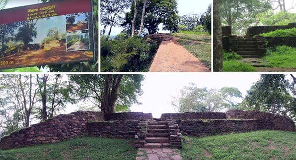
1092
CHAPTER 56. STRATEGIC STRONGHOLDS OF BALANA, THUMPANA, AND DEEWALKANDA
Figure 56.1: Balana Fort served as a critical military outpost during the Portuguese period and subsequent colonial eras.
(Declercq de Silva Archive)
56.2.3 Portuguese Incursions and Battles at Balana
During the Portuguese period, several military engagements underscored the strategic importance of Balana and the Kadugannawa Pass. The Portuguese, aiming to expand their control over the island, faced fierce resistance from the Kandyans. The Balana Fort served as a key defensive position in these conflicts. The rugged terrain and the fort’s fortifications enabled the Kandyans to mount effective defenses against the better-armed Portuguese forces.
One of the notable battles in this region was the Battle of Randeniwela in 1630, where the Kandyans, led by King Senarat and Prince Maha Astana, defeated the Portuguese. The victory at Randeniwela was a testament to the effectiveness of the Kandyan defense strategies, which relied heavily on the natural fortifications provided by the Alagalla Mountain Range and the Balana Fort.
56.2.4 The British Era and the Kadugannawa Pass
The strategic importance of the Kadugannawa Pass persisted into the British colonial period. The British, recognizing the need for a more direct route to Kandy, constructed a new road through the pass in the 1820s. This project, led by Captain Dawson, involved piercing a rock at the Kadugannawa Pass to create what is now known as the Kadugannawa Tunnel. The tunnel and the new road significantly improved access to the Kandyan highlands, facilitating the British consolidation of power in the region.
The construction of the Colombo-Kandy road through the Kadugannawa Pass was a remarkable engineering feat of its time. The road’s incline begins at 290 feet above sea level, passing through rugged terrain and reaching its peak near the Kadugannawa Dawson Tower at 1690 feet above sea level. This new route enhanced military and administrative control, boosting trade and communication between Colombo and Kandy.
56.3 Thumpana: A Battlefield of Portuguese Conflict in Sri Lanka
Thumpana, a historical site in Sri Lanka, is recognized for its strategic importance and the significant battles fought there during the Portuguese colonial period. Situated within the island’s intricate topography, Thumpana served as a crucial battleground in the resistance efforts of the Sinhalese kingdoms against Portuguese encroachment. This region’s historical relevance is underscored by its role in the broader narrative of Portuguese Ceylon and the fierce resistance mounted by the indigenous forces.
56.3.1 Strategic Location of Thumpana
Thumpana’s geographical position contributed to its strategic importance. Located in the Central Province of Sri Lanka, Thumpana lies within a region characterized by rugged terrain, dense forests, and mountainous landscapes. These natural features provided a formidable defense mechanism for the Sinhalese forces against the better-armed and organized Portuguese troops. The area’s challenging topography impeded the movement of large armies and offered numerous opportunities for ambushes and guerrilla tactics.
56.3.2 Portuguese Expansion and the Battle of Thumpana
The Portuguese arrived in Sri Lanka in the early 16th century to establish control over the island’s lucrative spice trade and exert political dominance. They faced significant resistance from the local kingdoms, notably the Kingdom of Kandy, which sought to preserve its sovereignty. Thumpana became one of the many sites where this struggle for control unfolded.
One of the most notable engagements in Thumpana occurred during the conflicts that marked the Portuguese attempts to subjugate the Kandyan Kingdom. The battle at Thumpana was symbolic of the fierce resistance offered by the Kandyans. Utilizing their knowledge of the local terrain, the Kandyan forces, under the leadership of their kings and military strategists, launched effective defensive and offensive operations against the Portuguese.
© 2024 Nico F. Declercq
The Desclergues of la Villa Ducal de Montblanc, 2nd ed., Omn., VOL. IV
56.4. DEEWALKANDA: THE ROCKY STRONGHOLD OF UDUWARA AND THE BATTLES OF
FERNANDO SAMARA DE CUNHA Y RALA (SAMARAKOON )
1093
56.3.3 The Dynamics of Warfare at Thumpana
The battles at Thumpana were characterized by the use of guerrilla tactics and strategic ambushes by the Sinhalese forces. The dense forests and uneven terrain provided ideal conditions for these tactics. The Kandyans, adept at navigating their homeland, utilized these advantages to launch surprise attacks on Portuguese encampments and supply lines. These tactics significantly hampered the Portuguese, who were more accustomed to conventional European warfare.
The Sinhalese forces also constructed temporary fortifications and utilized natural barriers to create defensive strongholds. These positions were often well-hidden and difficult to assault, forcing the Portuguese to engage in protracted and costly campaigns. The resilience and resourcefulness of the Kandyans at Thumpana exemplify the broader resistance efforts against colonial domination.
56.3.4 Historical Impact and Legacy
The battles fought at Thumpana were part of the more considerable resistance against Portuguese colonial ambitions in Sri Lanka.
These conflicts significantly contributed to the eventual decline of Portuguese power on the island. The sustained resistance, exemplified by the engagements at Thumpana, demonstrated the determination of the Sinhalese kingdoms to preserve their autonomy and cultural identity. The legacy of Thumpana is integral to the history of Portuguese Ceylon. It stands as a testament to the strategic insight and resilience of the Sinhalese forces. Although less renowned than other battlegrounds, the site played a crucial role in the protracted struggle for control over Sri Lanka. The lessons learned from the warfare at Thumpana influenced subsequent resistance strategies against other colonial powers, including the Dutch and the British.
56.4 Deewalkanda: The Rocky Stronghold of Uduwara and the Battles of Fer-
nando Samara de Cunha y Rala (Samarakoon)
Deewalkanda, a prominent rock in Uduwara along the Kalu Ganga in Sri Lanka, holds significant historical importance due to the battles fought there, particularly during the resistance against Portuguese incursions. This natural fortress, situated strategically, served as a vital defensive position for local leaders such as Samarakoon, who played a crucial role in the resistance against colonial forces. The history of Deewalkanda is intertwined with the broader narrative of Sri Lankan resistance and the efforts to preserve the island’s sovereignty and cultural heritage.
56.4.1 Strategic Importance of Deewalkanda
Deewalkanda, situated in the Uduwara region along the Kalu Ganga (Black River), is a remarkable natural formation that provides a formidable defensive stronghold. The rocky terrain and elevated position made it ideal for monitoring enemy movements and launching defensive operations. The Kalu Ganga, winding through the dense forests and rugged landscapes, added a layer of natural defense, complicating the logistics for any invading force.
56.4.2 The Battles of Deewalkanda and the Role of Samarakoon
During the Portuguese colonial period, Deewalkanda emerged as a critical site of resistance. Samarakoon, a prominent local leader, utilized the natural fortifications of Deewalkanda to mount a determined defense against Portuguese forces. The rock’s strategic position allowed Samarakoon to effectively coordinate guerrilla tactics, ambushes, and defensive maneuvers, leveraging the challenging terrain to his advantage. One of the critical battles at Deewalkanda involved Samarakoon’s forces launching surprise attacks on Portuguese troops attempting to penetrate deeper into the interior regions of Sri Lanka. The dense forest cover and the complex network of waterways in the area provided ample opportunities for ambushes. Samarakoon’s intimate knowledge of the local geography allowed him to orchestrate these attacks precisely, significantly disrupting Portuguese supply lines and troop movements.
56.4.3 Guerrilla Warfare and Defensive Strategies
The warfare at Deewalkanda was characterized by guerrilla tactics, which proved highly effective against the conventional military strategies employed by the Portuguese. Samarakoon’s forces utilized the natural barriers provided by the rock and the surrounding landscape to create hidden defensive positions. These positions were well-camouflaged and challenging for the Portuguese to locate and assault, allowing the defenders to inflict substantial casualties and retreat to safety when necessary.
The steep inclines and rocky outcrops of Deewalkanda made it arduous for the Portuguese to launch direct assaults. The defenders capitalized on this by setting up defensive lines that forced the attackers to navigate treacherous terrain, slowing their advance and making them vulnerable to attacks from elevated positions. This use of natural fortifications was a hallmark of the resistance strategies employed by Sri Lankan leaders like Samarakoon.
56.4.4 Historical Impact and Legacy
The resistance at Deewalkanda, led by Samarakoon, played a significant role in the broader struggle against Portuguese colonial ambitions in Sri Lanka. Local forces’ ability to effectively utilize natural fortifications and employ guerrilla tactics demonstrated the resilience and strategic ingenuity of the Sinhalese leaders. The battles at Deewalkanda contributed to the eventual weakening of Portuguese control and catalyzed resistance against subsequent colonial powers.
The legacy of Deewalkanda is a testament to the enduring spirit of resistance among the Sri Lankan people. The site symbolizes the determination to defend sovereignty and cultural identity against foreign domination. The strategic use of natural fortifications at Deewalkanda influenced resistance strategies in other parts of the island, underscoring the importance of understanding and leveraging the local geography in military conflicts.
56.5 Conclusion
The historical sites of Balana, Thumpana, and Deewalkanda collectively underscore the strategic and historical significance of the Central Province of Sri Lanka in the broader narrative of resistance against Portuguese colonialism. Each location, with its unique The Desclergues of la Villa Ducal de Montblanc, 2nd ed., Omn., VOL. IV
© 2024 Nico F. Declercq
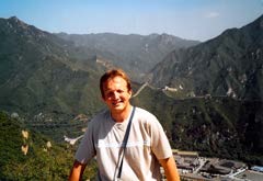
1094
CHAPTER 56. STRATEGIC STRONGHOLDS OF BALANA, THUMPANA, AND DEEWALKANDA
Figure 56.2: From left to right, we see Portugal 1979, Maurice A. Declercq, the author, and Anna Den Dauw at a water tank. Then, 1979, Portugal, Nazare, Nelly M. Vangheluwe, the author, Maurice A. Declercq, Anna Den Dauw.
Finally, in 1979, Melides, Portugal, the author. (Declercq de Silva Archive)
Figure 56.3: 1980, the author with a local friend in Cascais, Portugal,
near Lisbon. (Declercq de Silva Archive)
geographical and strategic attributes, played a crucial role in the defense efforts of the Sinhalese kingdoms, highlighting their determination to resist foreign domination.
Balana and the Kadugannawa Pass exemplify the strategic understanding and resilience of the Kandyan Kingdom. The Balana Fort, with its formidable defenses and strategic location, served as a critical position in repelling Portuguese incursions. The challenging terrain of the Kadugannawa Pass provided a natural defense line and a vital gateway to the island’s interior, underscoring its enduring significance into the British colonial period.
Thumpana’s historical significance lies in its strategic location, and the fierce battles fought there, which are marked by the resourcefulness and resilience of the Indigenous forces. The engagements at Thumpana, characterized by guerrilla tactics and the use of natural defenses, reflect the determination of the Sinhalese kingdoms to preserve their sovereignty against foreign invaders.
Deewalkanda, with its strategic location and natural fortifications, stands as a testament to the effectiveness of guerrilla warfare and the resilience of local leaders such as Fernando Samara de Cunha y Rala, Samarakoon. The battles fought at this rocky stronghold highlight the broader struggle for sovereignty and cultural preservation, a powerful reminder of the Sinhalese leaders’ strategic ingenuity and enduring spirit.
The legacies of Balana, Thumpana, and Deewalkanda form a vital chapter in Sri Lanka’s history. They reflect the enduring spirit of resistance against colonial oppression and the strategic importance of these formidable battlegrounds. These sites remain constant symbols of the resistance efforts that shaped the course of Sri Lankan history, showcasing the resilience and strategic understanding of the island’s defenders.
56.6 The Approach and Arrival of Portuguese until Establishment of the Por-
tuguese Kingdom of Kotte
O. M. da Silva Cosme1 is a professional lawyer and also historian. He researched for his book in Sri Lanka, Goa, and Lisbon. As mentioned above, Goa was the capital of the Portuguese Estado da India, of civil and ecclesiastical administration, trade, commerce, and social and cultural life. It remained Portuguese until it was annexed to India in 1961.
Fidalgo means Portuguese nobleman, similar to the Spanish term Hidalgo. In Sinhala, there used to be the word Pidalguwa, derived Figure 56.4: A visit to China without seeing a section
of the Great Wall would be incomplete. Marco Polo, the
Venetian merchant and explorer (1254-1324), famous for
his journey to Asia, including China, did not witness the
wall during his visit. This was because a significant por-
tion of the wall had not been constructed during his trav-
els. Accompanied by his father, Niccolò Polo, and his
uncle Maffeo Polo, Marco Polo’s exploration extended
beyond China, encompassing Malacca, Sri Lanka, and
India. Their return journey included traversing the Ara-
bian Sea to Hormuz and opting for a land route back to
Venice. They traveled around Jaffna in North Sri Lanka
before continuing their journey. The attached picture de-
picts a section of the Great Wall near Beijing, taken on
September 1, 2005. (Declercq de Silva Archive)
1O. M. da Silva Cosme, ’Fidalgos in the Kingdom of Kotte (Sri Lanka: 1505 - 1656), The Portuguese in Sri Lanka,’ Limited edition of 350 copies, copy no. 31 and signed by the author, published in Colombo, Sri Lanka, in 1990, by Harwoods Publishers, 38 1/1/, Dudley Senanayake Mawatha, Colombo 8, and printed by Evangel Press Limited, 490/8 Havelock Road, Colombo 6, Sri Lanka.
© 2024 Nico F. Declercq
The Desclergues of la Villa Ducal de Montblanc, 2nd ed., Omn., VOL. IV
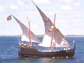
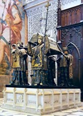
56.6. THE APPROACH AND ARRIVAL OF PORTUGUESE UNTIL ESTABLISHMENT OF THE
PORTUGUESE KINGDOM OF KOTTE
1095
Figure 56.5: 1982, Morocco, Tanger, the author, and Jeanette Ver-
brugghe. (Declercq de Silva Archive)
Figure 56.6: A small Caravel with two lateen sails. The author’s
team is involved in a major European project, including Greece and
Portugal, to investigate ship hulls for defects and biofouling using a
combination of robotics and ultrasound. Proper detection and mainte-
nance significantly reduce the cost of modern container ships in terms
of diesel consumption. In the future, naval transport will likely depend
again on the wind and other harvested energy forms. Courtesy of the
Navy of Brazil.
Figure 56.7: 1981, Dakar in Senegal with relatives and acquaintances of President, writer, and philosopher Léopold Sédar Senghor and at the Presidential Palace in Dakar, Senegal (Courtesy of President Abdou Diouf). The photo in the middle was taken at Hotel le Meridien in Dakar, Senegal. (Declercq de Silva Archive)
Figure 56.8:
A stamp depicting Bar-
tolomeu Dias; and 1979, the author with
his parents on the Portuguese coast. (De-
clercq de Silva Archive)
Figure 56.9: The tomb of Christopher Columbus in Seville, Spain.
(Declercq de Silva Archive)
The Desclergues of la Villa Ducal de Montblanc, 2nd ed., Omn., VOL. IV
© 2024 Nico F. Declercq
1096
CHAPTER 56. STRATEGIC STRONGHOLDS OF BALANA, THUMPANA, AND DEEWALKANDA
Figure 56.10: From left to right, we find a Portrait of Vasco Da Gama, Viceroy of India,
around 1525; the original tomb of Vasco da Gama at Kochi in India (Saint Francis church); a
1979 photo of Mosteiro dos Jerónimos at Belém, where Vasco da Gama was (re)buried in Lisboa,
Portugal; the tomb of Vasco da Gama in Lisboa, Portugal, in 1979; and a 1980 Belem visit in
Lisboa, Portugal, including the tomb of Vasco da Gama. (Declercq de Silva Archive)
Figure 56.11: 1979, the Portuguese coast. Snapshot of a moving
image. (Declercq de Silva Archive)
from the Portuguese name2. By the way, ’Portugal’ comes from ’Cale,’ which was transformed into Portus Cale and became Portugal around 700.
When they arrived in Sri Lanka, it was evident that the Portuguese must have been eager to adopt place names such as Galle in the country’s southwest because it sounded similar to what they knew.
Also, the port of Colombo must have sounded familiar as it is one of the European forms of Columbus. However, the similarity is a coincidence as the town existed already before the arrival of the Portuguese, explained further and also in Chapter 52.
As was mentioned above, the motivation to find India along a maritime route originated from a blockage of the land route to India.
Indeed, from around 1450 onwards, European trade was in dire straits because the traditional land routes to Asia had become unsafe after the Mongol empire’s breakup. Also, there were hostilities caused by the Ottomans, who made commerce with Asia along the Mediterranean Sea and the Middle East almost impossible.
Therefore, the West became obsessed with finding new sea routes to Asia. Henry of Portugal was perhaps the first to transform the desire into actual policy. Indeed, the Portuguese were the most experienced seafarers over actual rough seas, for instance, through trade along the Atlantic to France and the southern and northern Netherlands.
Still frustrated with the Moors, Henry wanted to spread Christianity south into Africa, again along the Atlantic coast. The Portuguese conquest of Ceuta in North Africa also increased the Portuguese drive in that direction.
The author visited Portugal in 1979, 1980, and 1981 and still has sweet memories of those journeys. Some pictures are shown in Figures 56.2 and 56.3.
56.6.1 Explorations and Navigation that Paved the Road to Sri Lanka
As da Silva states in his book, ’The voyages of discovery, make a wonderful saga of romance, deeds of daring, adventure, human suffering and endurance; tragedy and cruelty run throughout their history, making every page absorbing and interesting.’ Yet, they may have had a great time upon arrival, such as in 56.35 on page 1104.
The Portuguese went to India step by step and discovered place after place.
The Portuguese knew very well where India, China, and Japan were located, thanks to Marco Polo (who had never seen the Great Wall in Figure 56.4), the Venetians, and the Arabs. Still, they searched a route around Africa to circumvent the monopoly of the Arabs and Venetians.
It was in 1418 that the island of Porto Santo was visited, followed by Madeira in 1419. The Portuguese visited the Azores between 1427 and 1431.
Note that Flemish persons were also involved in the conquest of the Azores. Indeed, there was a secure commerce connection between Flanders and Portugal and between Flanders and Spain.
Cape Bojador down the African coast was visited in 1434, and Rio de Oro in 1436. In 1437, an unsuccessful attempt to capture Tanger was made in Figure 56.5. In 1439 the Azores were colonised. Note that the Azores were not habited before the Portuguese arrival. From 1445 onward, the Azores exported sugar.
The Portuguese could sail deeper down the African coast thanks to lighter ships such as the caravel with 2 or 3 masts and lateen sails, sometimes square-rigged. A lateen, also called a Latin rig, is a triangular sail mounted at an angle on the mast. It existed for centuries in the Mediterranean, but it had not been considered before for use on ocean ships. In contrast to Caracks, which had mainly rectangular sails, Caravels, as in Figure 56.6, were equipped primarily with lateen sails, were minor, and were better capable of tacking against the wind.
Interestingly, the Caravels were very popular, and they were also used. An armada consisted of different ships, probably because each had its military function, such as Caracks being the floating fortresses and Caravels being very maneuverable, even against the wind. Military ships were quickly converted to commercial ones, and vice versa, or sometimes both functions were combined simultaneously.
1443, the Portuguese reached the Bay of Arguin; in 1444, they reached the Cape Verde Islands. Dinas Dias reached the mouth of the Senegal River in 1445. In 1445 they reached the Gambia, and in 1456 they reached the Cape Verde Islands.
2Note that ’f’ traditionally did not exist in Singhalese and was automatically substituted by ’p’ . For instance, ’Fanta’ ® was pronounced ’Panta’
© 2024 Nico F. Declercq
The Desclergues of la Villa Ducal de Montblanc, 2nd ed., Omn., VOL. IV
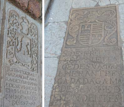
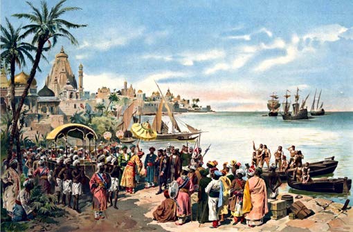
56.6. THE APPROACH AND ARRIVAL OF PORTUGUESE UNTIL ESTABLISHMENT OF THE
PORTUGUESE KINGDOM OF KOTTE
1097
Figure 56.12: Two graves of Da Gama in the Saint Augustin Church of Goa.
(Goa, 2019) (Declercq de Silva Archive)
Figure 56.13: A depiction of Vasco da Gama’s arrival at Calicut in 1498 by Alfredo Roque-Gameiro. The
three Portuguese vessels shown on the top-right of the image are two Carracks and one Caravel. p
Figure 56.14: In 1980, the author enjoyed the Tagus River with Pierre Vangheluwe
and Jeanette Verbrugghe and visited Torre de Belém. (Declercq de Silva Archive)
The Desclergues of la Villa Ducal de Montblanc, 2nd ed., Omn., VOL. IV
© 2024 Nico F. Declercq
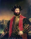
1098
CHAPTER 56. STRATEGIC STRONGHOLDS OF BALANA, THUMPANA, AND DEEWALKANDA
Figure 56.15: Pedro Álvares Cabral.
Figure 56.16: Schematic of the sea routes to Asia and America. The
Green arrows indicate the road back and forth from Lisbon or Cadiz to
Cuba. The blue arrows show the path to India, and the yellow ones show
the route from India. In the East of Africa, sailing around Madagascar
or remaining close to the coast was an option. The Iberians discovered
these routes, which the VOC, the British Empire, and the French later
exploited. The departure was in Cape Verde’s direction from Iberia,
while the return was by the Azores. (Declercq de Silva Archive)
The author visited those areas in 1981, in Figure 56.7. The Portuguese hoped to find a new route to India from that moment onwards because Africa’s coastline turned eastwards. As we know, they would later be disappointed when they discovered that the coast turned South again further, but they did not give up and would continue, step by step, to sail more deeply to the South of Africa and would then finally discover that they were floating around the continent towards India.
In 1458, military expeditions began under King Alfonso V, who must have dreamed of conquering new areas overseas when watching the Portuguese coast as in Figure 56.8.
Indeed, in 1458, the first such expedition was sent to Morocco.
By 1460, when King Henry died, Africa’s coast had been reached until Sierra Leone. In 1471, Tanger and Arzila were conquered.
Between 1481 and 1482, a fortress was constructed at Elmina in the Gulf of Guinea, which served as a trading post, called Sao Jorge da Mina.
With their misinformed history classes at school, Belgians think of Livingston when considering the Congo River.
However, it was Diogo Cam who, in 1482, discovered the mouth of the Congo. The same person reached Cape Cross in 1486. By Pero da Covilha in 1487, the Portuguese found that India could be reached through a land route via Egypt to the Red Sea and the Indian Ocean. It gave them hope that it must have been possible to travel around Africa, which motivated them to sail further South to find the continent’s southernmost tip.
In 1488, Bartolomeu Dias, in Figure 56.8, rounded the southern end of Africa and sailed into the Indian Ocean. He called the southern tip the ’Cape of Storms,’ later called the ’Cape of Good Hope.’
Indeed, a pillar was found in 1938 in False Island, about 30 miles from the Great Fish River, and proved that the Portuguese were there in the year known to historians.
In 1477, Christopher Columbus, whose tomb is seen in Figure 56.9, settled in Lisbon, the center of cosmography and astronomy.
Later, he went to Madeira and also Sao Jorge da Mina. Being experienced as a sailor, he wanted to sail west to China (then called Cathay). He believed, or at least argued, that Japan (then called Cipango) was just 25000 nautical miles west of the islands of the Canaries in the Atlantic.
We should also note that Columbus’s brother was a cartographer in Lisbon, and Columbus’ wife belonged to one of Portugal’s most prominent families, Perestrello e Moniz. Nevertheless, Columbus needed help convincing the Portuguese King John II to financially support his efforts to find Asia in the West. Indeed, the Portuguese were focused on their search to go around Africa to India.
Finally, Columbus was supported by Ferdinand and Isabella from Spain. After discovering Cuba, Columbus believed that he had found Ptolemy’s Golden Chersonese (i.e., the Malay Peninsula) and passed Cipango.
In the framework of the many stories about the actual identity of Christopher Columbus, we must emphasize here that Christopher Columbus’ wife was the daughter of a Portuguese nobleman of Lombardian descent. This is the only indisputable link with Genua.
He either married her because of this Genoese link, or he married her because her father was a Portuguese nobleman. Both options make sense.3
The discovery of the New World by Christopher Columbus on behalf of Castile caused a dispute between the Spanish and the Portuguese. According to a treaty between both, Castile was not supposed to interfere with the Atlantic’s Portuguese activities.
Pope Alexander V, a Spaniard, issued bulls to protect both countries’ interests.
This was done in 1493 by a line 345 miles beyond the Azores and the Cape Verde Islands. The idea was simple. Anything West of this line would be Spanish. Everything east would be Portuguese. The Portuguese were more experienced than the Spanish and knew that if they wanted to go around Africa, they would have to use the wind South of the equator, bringing them further West Figure 56.17: In November 1997, the author went on a catamaran a
few miles from Sri Lanka near Kalutara. The sea was calm, as Figure
56.18 explained. When the monsoon causes north-western winds, the
sea is usually very rough, so swimming or navigating in June and July
is perilous. (Declercq de Silva Archive)
3The only thing that does not make sense is that the Genoese theory of the birth of Columbus states that he was the son of a wool weaver, a middle-class man. Even though documents show that there was such a wool weaver in Genua who had a son, Christopher, whose family name was Columbus (all in the Ligurian format), it should not be used as conclusive evidence that he was born in Genua. A name is certainly not unique. For this reason, we should not ab initio reject the Catalan claim of Columbus’s identity and the disguise of his true identity caused by the competition between the Crowns of Castile and Aragon. Upon his first return from America, we should remember that Columbus arrived in Barcelona. There is also a Portuguese claim that we should keep in mind. The fact is that most historians are convinced, based on documentation, that Columbus was, indeed, Genoese. The point that many people still doubt is beneficial for supporting further investigations, such as DNA analysis. The reader may also check Chapter 8.6
© 2024 Nico F. Declercq
The Desclergues of la Villa Ducal de Montblanc, 2nd ed., Omn., VOL. IV
56.6. THE APPROACH AND ARRIVAL OF PORTUGUESE UNTIL ESTABLISHMENT OF THE
PORTUGUESE KINGDOM OF KOTTE
1099
Figure 56.18: Wind patterns of the Monsoon. Yellow is summer,
and blue is Winter. For instance, the West Coast of Sri Lanka has a
very calm sea in Winter because the water is not disturbed by the wind,
as it’s tranquil in the shadow of the island for wind coming from the
Northeast. In Summer, however, the sea is rough, and there are also
rains coming from the Arabian Sea. (Declercq de Silva Archive)
Figure 56.19: Right is Edmund Halley, before 1722. Courtesy of the National
Portrait Gallery. In the middle is a map produced in 1702 by Edmund Halley, and
it shows the deviations of the magnetic lines on the Atlantic Ocean. The author has
sweet memories of the stamp on the left. In 1986, Sri Lanka issued stamps of Halley
and his comet. Edmund Halley had discovered that several reported comets were the
same re-appearing one. The one named after him is visible from Earth every 75
years. The last time was in March 1986; we expect it again around 2061. (Declercq
de Silva Archive)
Figure 56.20: The author saw the Southern Cross for the first time during his visit to Melbourne
in, Australia in March 2003. The author promised his eldest son that he would snap pictures of
kangaroos in Australia and take a one-day tour just before the beginning of his congress. On that
tour, there was an American couple with their daughter. The father had a good conversation with
the author about Australia. At some point, the father advised his daughter about a particular
problem. He urged his daughter to ’always keep walking, no matter what.’ The author has
always remembered these words and keeps them close to the heart. No matter your problem,
’keep walking’ is still the best solution, even if you only take small steps at a time. During
that tour, the blue mountains were visible in the distance, named after their color caused by
diffraction and Lord Rayleigh’s first explanation. The latter is John William Strutt (1842-1919),
who is considered the father of acoustics, although he also worked in optics. (Declercq de Silva
Archive) Left, we see an image of John William Strutt (1842-1919), Rayleigh’s lord and modern
Acoustics’s father.
Figure 56.21: Portrait of John Harrison (1693-1776), by Philippe Joseph Tas-
saert (1732-1803), after an original painting of 1767.
The Desclergues of la Villa Ducal de Montblanc, 2nd ed., Omn., VOL. IV
© 2024 Nico F. Declercq
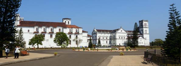

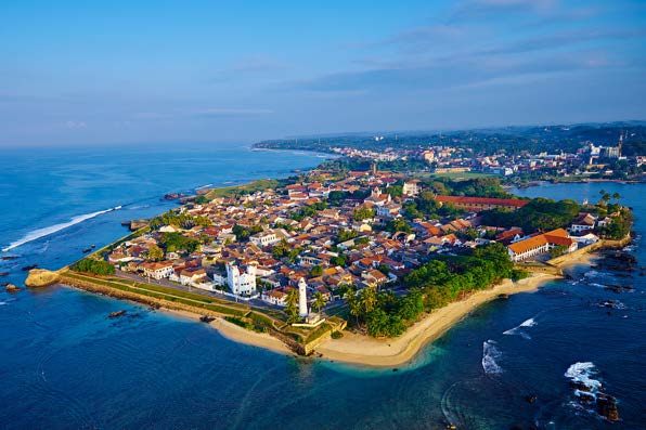
1100
CHAPTER 56. STRATEGIC STRONGHOLDS OF BALANA, THUMPANA, AND DEEWALKANDA
Figure 56.22: The downtown of old Goa in India. (Goa, 2019) (Declercq de Silva Archive)
Figure 56.23: Portuguese ship sculptured above the Santa Monica church entrance
of Goa (Institute Mater Dei Santa Monica Old Goa 403402). (Goa, 2019) (Declercq
de Silva Archive)
Figure 56.24: The author, in 1985, In Koggala, just south of Galle. When the
Portuguese arrived in 1505 near the shore, they must have seen the stilt fisherman
near the beach had they been there. Historians, however, agree that the practice
originated in WWII because of food shortage. (Declercq de Silva Archive)
Figure 56.25: Recent aerial view of Galle. The photo was taken by Tuul and Bruno Morandi (used with permission). The author stayed a week at Leynbaanstreet with the Gaffoor (Al Ameen) family in 1997 while Salmonella had struck him down.
On Friday, while having a very high fever and staring at the high walls and ceiling from his bed, the author heard the Islamic prayers in the nearby mosque and thought he had been kidnapped somewhere in Lebanon. Mr Gaffoor was an intelligent person who taught the author several crucial attitudes to dealing with fellow humans, particularly Sri Lankans. (Declercq de Silva Archive)
© 2024 Nico F. Declercq
The Desclergues of la Villa Ducal de Montblanc, 2nd ed., Omn., VOL. IV
56.6. THE APPROACH AND ARRIVAL OF PORTUGUESE UNTIL ESTABLISHMENT OF THE
PORTUGUESE KINGDOM OF KOTTE
1101
Figure 56.26: In this compilation of 1997 images, we view the town of Galle from within. Muslims mainly inhabit the city, but it has been a Portuguese fortress, followed by the VOC’s occupation. We can also observe the Portuguese ’feitoria,’ used by the VOC at the fortress. The VOC probably made enlargements, possibly the British, too. In 1997 Galle, there were still traditional gem cutters and polishers, although modern technology was also available. Sri Lanka is very famous for its Ceylon Blue Saphire, Rubis de Ceylan and other gems. The country is also one of the major import countries for fake gems. Therefore, one must be extremely cautious when buying gems in Sri Lanka and become an expert before doing so. One can find the real ones, but the fake ones, too. Galle’s harbor is also seen from the town’s shore. Then, a view from Galle in 2014 is presented. Ships still pass from Singapore, India, and China to the Red Sea and the Persian Gulf, just as they did during the Portuguese and VOC periods. The ’Point de Galle’ was a busy area for ships between Malacca and Goa. Interestingly, blue whales do not reside far from the coast of Galle. Their existence was known around a decade ago. (Declercq de Silva Archive)
Figure 56.27: July 2007: A view of Galle and its harbor from Rumassala temple, on the opposite side of the bay.
(Declercq de Silva Archive)
Figure 56.28: 2014, July 31, two Buddhist monks enjoyed the view
of Galle during sunset from Rumassala temple. (Declercq de Silva
Archive)
The Desclergues of la Villa Ducal de Montblanc, 2nd ed., Omn., VOL. IV
© 2024 Nico F. Declercq
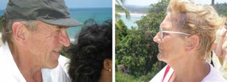
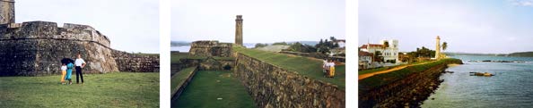
1102
CHAPTER 56. STRATEGIC STRONGHOLDS OF BALANA, THUMPANA, AND DEEWALKANDA
Figure 56.29: 2007, the author’s father,
Maurice Declercq, with his daughter-in-
law, and the author’s mother, Nelly Maria
Vangheluwe, watched the bay of Galle from
Rumassala temple.
(Declercq de Silva
Archive)
Figure 56.30: 2007, the author’s mother, Nelly Maria
Vangheluwe, grand-auntie Mariette Vroman, and fos-
ter mother, Jeanette Verbrugghe, were watching the bay
of Galle from Rumassala temple. (Declercq de Silva
Archive)
than this theoretical line. Therefore, the line hampered future Portuguese explorations.
For this reason, King Joao of Portugal forced a new treaty with the Spanish. Indeed, the Treaty of Tordesillas of 1494 moved the vertical line further West, 1300 miles West of Cape Verde’s islands.
The new line allowed the Portuguese to sail further West when trying to circumvent Africa. During one of such attempts, Cabral discovered Brazil and claimed it virtually as Portuguese territory as it was found East of the line of Tordesillas.
There was another bull, in 1455, by Pope Nicolas V, which reserved African discoveries to the Portuguese.
Although the Spanish found the Americas through Columbus’s voyages, Vasco da Gama, shown in Figure 56.10, made the ultimate voyage from Portugal around Africa to India.
From an economic perspective, this was the most meaningful event and eclipsed the Spanish then. Da Gama’s tombs are also shown in Figure 56.10.
The author married in Sri Lanka, on the Indian Sub-Continent, 500 years minus one month after the beginning of the first voyage of Vasco da Gama to India. His foster father, Pierre Vangheluwe, who had shown him, Sri Lanka, from 1985-1988, died on July 8, 1991, which is, to the day, exactly 494 years after Vasco da Gama departed to India, from Lisboa, along with the beautiful Portuguese coast in Figure 56.11. The Da Gama family was thriving in Goa, as seen in Figure 56.12.
The ships of Vasco da Gama reached Calicut, in Figure 56.13, in the Spring of 1498. He returned successfully to Lisbon in the fall of 1499, 500 years before the author’s first child’s birth.
Note that it was Amerigo Vespucci, an Italian merchant, who discovered the mainland and who figured out that the newly discovered islands by Columbus belonged not to Asia but a new continent, hence the name of the new continent given by the German geographer Waldseemuller in 1507 who named the continent America.
Later, other European countries, such as England, France, and the Northern Netherlands, played a role in the discoveries and claimed their parts. Belgium played a separate role in the Austrian Netherlands or Austrian Belgium era because they were effectively part of Spain.
They were involved in the global sea routes in Spain and Portugal and had their separate task of distributing goods imported through Cadiz or Lisbon to the rest of Northern Europe. We should also remember Venice, which continued to play an essential role in trade in the Mediterranean.
However, the big star around 1500 was Portugal, which discovered the new sea route to India.
The reign of Manoel the Fortunate4 transformed Portugal from a discovering nation to a colonizing or occupational country and initiated a military expansion.
Indeed, the Portuguese did not necessarily arrive in a paradise everywhere and met resistance, primarily from Muslim merchants who feared their monopoly was in danger.
For instance, the ruler (i.e., the Zamorin) of Calicut was forced by the Muslims and Christian-Syrian merchants to be hostile towards the Portuguese newcomers and to make Vasco da Gama return home. It is known that da Gama had to fight his way out.
The difficulties encountered and overcome by the Portuguese in that era are tremendous and still baffle historians. Anyone who appreciates Portuguese adventures should visit the Tagus River and the Belem Tower. Some impressions are shown in Figure 56.14.
Figure 56.31: The author is shown left and center with his wife and Mr Gaffoor’s daughter (from Al Ameen, Leynbaanstreet, also mentioned in Figure 56.25), Galle Fort, 1997. The Portuguese constructed the fortress, which the VOC later reinforced.
Right, we see the watchtower and the mosque (also mentioned in Figure 56.25). (Declercq de Silva Archive) 4He was fortunate because all the right things were happening to him, and his Kingdom had reached its status as a consequence of the innovative strategies by his predecessor King Joáo II.
© 2024 Nico F. Declercq
The Desclergues of la Villa Ducal de Montblanc, 2nd ed., Omn., VOL. IV
56.6. THE APPROACH AND ARRIVAL OF PORTUGUESE UNTIL ESTABLISHMENT OF THE
PORTUGUESE KINGDOM OF KOTTE
1103
Figure 56.32: The Fort Hotel of Galle, with its British Colonial look, was initially a Dutch
mansion constructed in the 17th century but was significantly renewed by the British, hence its
colonial look. The person walking in view is the author’s mother, July 2007. (Declercq de Silva
Archive)
Figure 56.33: Gems near Uduwara, 1985. Sri Lanka is very well known for its Ceylonese
Blue sapphire. Blue sapphire forms in granitic pegmatites during the final stage of a magma’s
crystallization and are corundum syenites, a crystalline form of aluminum oxide typically con-
taining traces of elements such as iron, vanadium, magnesium, chromium, and titanium. Its
light blue color generally shows an internal grain structure, also called defects. An artificial blue
sapphire looks naturally pure and is often much darker than the Ceylonese blue sapphire. Some-
times, sapphires undergo heat treatment to make them more perfect, but they are more difficult
to distinguish from fake ones. One must, indeed, be very cautious. A Ceylon sapphire is most
valuable when untreated. An example is the Stuart Sapphire, a 3.8 cm long and 2.5 cm wide
stone, in Queen Victoria’s State Crown. The massive blue Saphire comes from Sri Lanka but
was not taken by the British, unlike some stories on the island. Sri Lanka was the primary
origin of gems in the classical period and can be found, for instance, in Etruscan jewelry. There
was a massive trade of gems from the island all over the Mediterranean. The Stuart Saphire
dates to 1214 and is a 104-carat Ceylonese blue sapphire. The stone belonged to Charles II and
was taken by James VII when he fled to France in 1688. After a long journey, it was purchased
by George III in 1807 and returned from Italy to the United Kingdom. It was finally placed on
the Imperial State Crown of HM Queen Victoria, perhaps because she knew it was Ceylonese,
the jewel on her crown. The gem remains on HM Queen Elizabeth II’s Imperial State Crown,
made in 1937. Courtesy of the Jewel House, Tower of London.
Figure 56.34:
When the Portuguese
sailed from Galle to Colombo, they must
have seen the Kalu Ganga’s estuary. They
would later build a fortress, and on which
foundations now stand one of the most
famous Buddhist stupas of recent history.
(areal view, courtesy of the Kalutara Bud-
dhist Society)
The Desclergues of la Villa Ducal de Montblanc, 2nd ed., Omn., VOL. IV
© 2024 Nico F. Declercq
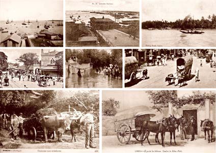
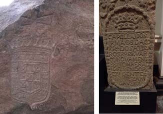
1104
CHAPTER 56. STRATEGIC STRONGHOLDS OF BALANA, THUMPANA, AND DEEWALKANDA
Figure 56.35: Fun in Sri Lanka, sum-
mer 2019, with Mahinda, Hema, Michael,
Sudharshana and Nilusha, friends forever.
Figure 56.36: Old images of Colombo. We can see, for instance, typical street scenes in
Colombo around 1900 or the harbor in the 19th century. The lower pictures were taken in
Portugal; still, it could easily be mistaken for Sri Lanka. Indeed, there have been numerous
similarities in the countries’ past. The Monsoon, also shown, regularly causes floods in
Sri Lanka, a regular event during the Portuguese era.
Figure
56.37:
Left, the Padrao in
Colombo is shown (Sri Lanka, 2019).
Right is a stone slab with a Portuguese
inscription, probably fixed to a Portuguese
chapel’s central doorway in Colombo fort.
It concerns the Chapel of the Brethren of
the Confraternity of the Most Holy Rosary.
Its arch was rebuilt in 1647, with Balthazar
da Veiga as President. The author took
the picture at the National Museum of Sri
Lanka, Colombo, on August 8, 2014. (De-
clercq de Silva Archive)
Figure 56.38: The main struggle between the Portuguese marines
and those of the Arabs was to control the Mediterranean trade routes
to Asia. Indeed, if the Portuguese could end trade through the Persian
Gulf and the Red Sea, they would obtain a monopoly thanks to Africa’s
route. This photo was taken in Bahrain, in the Persian Gulf, in August
2000. (Declercq de Silva Archive)
© 2024 Nico F. Declercq
The Desclergues of la Villa Ducal de Montblanc, 2nd ed., Omn., VOL. IV
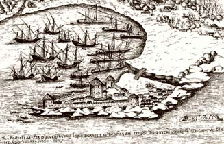
56.6. THE APPROACH AND ARRIVAL OF PORTUGUESE UNTIL ESTABLISHMENT OF THE
PORTUGUESE KINGDOM OF KOTTE
1105
Figure 56.39: An engraving from Lendas
da India, Vol. II, by Gaspar Correia.a It
shows Colombo harbor with the fortress in
1526.
aPedro Dias, «Portugal e Ceilão, Balu-
artes, Marfim e Pedraria.
Figure 56.40: The author with Michael
Roman and Guard of Honor recipient Ma-
jor General Priyantha Dissanayake of the
Sri Lankan Military Engineering Corps in
2019. They visited the construction site of
a new dam to provide water to the wildlife
and farmers.
In March 1500, Pedro Alvares Cabral, in Figure 56.15, was dispatched by Manoel the Fortunate to India. He went with 13 ships to impress the Indian rulers. When he used the winds to circumvent Africa, as advised by Vasco da Gama, he discovered Brazil during his voyage. The Portuguese were unaware they had found a southern part of America and thought it was an island. They called the island Terra da Santa Cruz. After the discovery, Pedro Alvares Cabra sent one ship back to Portugal to inform the King while the others continued their voyage toward India.
Four boats with all men on board during that voyage, including the famous Bartolomeo Diaz, disappeared.
Cabral, perhaps somewhat desperate after the losses and further motivated after the discovery of Brazil, arrived in Calicut and released immense cannon fire to impress the Indians. The display was successful as he could force a treaty between the ruler of Calicut and the Portuguese.
A Portuguese settlement was established, and 54 men stayed behind to man the accommodation. They would, however, soon all be killed by the Indians.
Cabral learned his lesson and decided to use more force from now on. Therefore, he bombarded Calicut to avenge his inmates’
deaths, which inevitably impressed the raja of Cochin, a dependency of Calicut, as he turned out friendlier towards Cabral and allowed the Portuguese to install the first European settlement in India successfully at Cochin.
The Portuguese could then sail away.
In 1500, Diogo Dias discovered Madagascar. Joao da Nova reached Cochin in 1501, and Ascension Island was located in 1501 while St Helena in 1502.
At Cochin, Joao da Nova established a trading post at Cannanore, a center for trade in Ginger, Pepper and Timberwood.
In 1502, Vasco da Gama went to India with 20 ships to punish the Zamorin of Calicut as a final retaliation for the killings done by the Indians 2 years before. On the way to India, da Gama also formed political relations with rulers along the African coast, such as modern-day Tanzania, Sofala, and Mozambique. He, too, overwhelmed the Muslim merchants in the Indian Ocean with immense force.
Indeed, the Portuguese had reached a point of no return in conquering the world and could no longer allow competitors to stop their expansion. For instance, da Gama destroyed a Muslim fleet of 28 vessels, and he also heavily bombarded Calicut.
As a result, he forced a peace treaty with the local ruler in December 1503, after which he could return to Portugal as a real victor, carried by 13 vessels filled with goods from India.
In 1503, Alfonso de Albuquerque entered the arena. Indeed, he was despatched to India, and it was his task to build the first Portuguese fortress in Cochin. Thanks to this fortress, Pachecho Pereira could withstand 1504 attacks from the armies of the Zamorin of Calicut.
Besides the fort at Cochin, Albuquerque also established a trading post at Quilon before returning to Portugal in July 1504. His successes allowed him to become one of the policymakers of King Manoel.
For the reader unfamiliar with the wind patterns and the connected trade routes, we shall make a summary guided by Figure 56.16.
The sun is the driving force of the wind in our atmosphere because its heat increases the humidity or raises air because it becomes less dense, or both. The Earth’s gravity ensures that the layer of air covering our planet tends to stick as closely as possible to it The Desclergues of la Villa Ducal de Montblanc, 2nd ed., Omn., VOL. IV
© 2024 Nico F. Declercq
CHAPTER 56. STRATEGIC STRONGHOLDS OF BALANA, THUMPANA, AND DEEWALKANDA
so that a volume increase or decrease due to heating or cooling equally causes air displacements. Air that lifts tends to decrease the pressure underneath and sucks in air from neighboring regions, while air that comes down causes the opposite. During such lift, humidity may transform to rain due to temperature decrease, while the remaining air becomes dryer. The combination of the effects causes the conception of convection cells. Three classes of convection cells exist Polar cells near the North and South poles, Mid-Latitude cells between roughly 60 and 30 degrees North, and between 60 and 30 degrees South. Hadley cells are caused by a strong lift of air on the equator (causing equatorial rains) and a downward motion about 30 degrees North or South from the equator.
The constant air movement is influenced by night and day patterns and seasons determined by the sun’s height. It occurs at every altitude in the atmosphere. Aeroplane pilots are very interested in airflow in higher regions of the atmosphere, while naval captains search for the most efficient winds above water.
In addition to the effects caused by the sun, there are also effects caused by oceanic water streams that may stabilize the atmosphere, cool it, or heat it. Furthermore, such flows may or may not be helpful for sailing boats to gain speed. Of crucial importance for the sea voyage routes to the Americas and Asia is the effect caused by the rotation of the Earth.
This force is now called ’Coriolis Force’, but few people truly understood it during the Iberians’ great explorations. However, thanks to studies initiated by Henry the Navigator and the numerous Iberian explorers, mainly the Portuguese, wind patterns were mapped and exploited.
Indeed, the wind rotates clockwise or counterclockwise thanks to the Coriolis Force, making voyages very convenient if appropriately used. If not used properly, a ship may be stuck and disappear or waste too much time. In general, winds in the northern hemisphere turn clockwise, while winds in the southern hemisphere turn counterclockwise.
Nowadays, some aspects of what is labeled as ’Coriolis Force’ were studied in the framework of cannonballs’ long-distance firing.
Indeed, when a cannonball leaves its cannon, it has a velocity in the barrel’s direction and another that is determined by the Earth’s spinning. When the ball increases in height, its trajectory is influenced by its initial ground velocity and its initial speed regarding the barrel. It is accelerated by the expanding hot air ignited by black powder.
The trajectory is equally influenced by the direction in which the ball is fired. If, for instance, the cannonball is shot in the Northern hemisphere to the North, then it will become slightly ahead in speed compared to the ground.
Proper observation of these effects is fundamental to aiming correctly and hitting a target. However, similar phenomena influence the wind’s direction as air is lifted from the Earth and then blows North or South. Air transportation’s long duration and path transform a rectilinear way into a spiral one, causing clouds and wind to rotate clockwise in the Northern hemisphere and counterclockwise in the Southern.
The observation of the Coriolis force, without complete understanding, appeared in the 17th century, for instance, in the work of Giovanni Battista Riccioli and Francesco Maria Grimaldi5, or by Claude François Milliet Dechales, in his work ’Cursus seu Mundus Mathematicus’, published in 1674. Christopher M. Graney also describes an overview of this history6.
1749 Euler derived the proper mathematical formula to describe the Coriolis acceleration. Pierre Simon Laplace later properly described the effect in 1778 in his tidal equations. In 1835, Gaspard Gustave Coriolis published a paper on energy conservation principles applied to spinning wheels in machines. In his work, Gaspard Gustave Coriolis separately studied forces different from the centrifugal force due to rotation. Although he named them ’compound centrifugal force,’ all other scientists would refer to it as
’Coriolis Force.’
William Ferrel did the first proper scientific study connecting the wind direction with the Coriolis force 1856. A complete theory regarding pressure gradients followed early in the 20th century. Nowadays, the notion of ’isobars’ on a weather map is crucial to explaining the weather.
It’s crucial to observe wind blowing from West to East, in the North and the South near the poles, to understand the routes to navigate the oceans. These winds are known as ’the westerlies’ and were well-known before the exploration era and made it very hard for North Europeans to cross the sea without first sailing to Iberia’s tip. Indeed, winds were blowing South and West from Iberia, allowing a proper departure. These winds and others that differed from the Westerlies were called the ’Trade Winds.’
Indeed, only those who understood the trade winds knew how to reach Asia and the Americas. Etymologically, the word ’trade’
originally meant ’path’ in old English.
Sometimes, the trade winds near the equator, continually blowing from East to West, are also referred to as Easterlies. The Portuguese used to call these winds the Volta do mar or the ’turn of the sea.’
This expression originates from the Portuguese’s early navigation, who could not reach the Azores straight from Portugal but had to follow the wind South and the winds blowing from East to West to arrive in the Southwest of the Azores before they could reach the archipelago.
So, they had to make this tour, or this ’turn of the sea,’ i.e., the volta do mar. It also provided them with a safe return from the Azores to Portugal. Similar turns exist in the Pacific and may have caused Asians to be blown, in sailing boats, to North America long before recorded history. Perhaps this is how the Native Americans arrived from Asia.
Note also that the Westerlies south of Africa allow sailors to reach Australia easily and is how the first explorers7 discovered Australia.
In Asia, sailers also established trade routes thanks to the wind. The most important one passed along Sri Lanka near Colombo and Galle. It’s interesting to get on a boat in Sri Lanka and leave the coast, as the author did in a Catamaran in 1997 in Figure
56.17, to receive an impression of this naval highway.
The Arabs had discovered the prevailing winds, shown in Figure 56.18, to reach Indonesia from the Arabian peninsula and governed sea trade along this route until the Portuguese’ appearance. In that area, it is of vital importance to understand the Monsoon. The Monsoon determines when a ship should sail towards its destination. This knowledge is essential for traders and the military, who must realize these constraints for their purposes or to predict an enemy’s passage.
The Monsoon has two branches, i.e., the Arabian Sea and the Bay of Bengal. In summer, the Monsoon blows air in a clockwise rotation, and in Winter, in a counterclockwise direction. To reach Goa, for instance, from the East African coast, one must wait until Summer. To sail back from Goa to Africa, one must wait until Winter.
The cause of the Monsoon is very complex and has yet to be fully understood. However, observing the directions in the different seasons was crucial for sailors. It also allows us to understand the importance of Goa. Indeed, vessels from the Arabian peninsula would always reach Goa before traveling South and East towards Indonesia. Having control of Goa was equal to controlling this trade route.
5Giovanni Battista Riccioli and Francesco Maria Grimaldi, ’Almagestum Novum,’ 1651
6Christopher M. Graney, ’Coriolis effect, two centuries before Coriolis.’ Physics Today. 64 (8): 8, in 2011.
7The Portuguese traditionally believe that they have been the ones who discovered Australia but kept it secret.
© 2024 Nico F. Declercq
The Desclergues of la Villa Ducal de Montblanc, 2nd ed., Omn., VOL. IV
56.6. THE APPROACH AND ARRIVAL OF PORTUGUESE UNTIL ESTABLISHMENT OF THE
PORTUGUESE KINGDOM OF KOTTE
1107
Sailing around South Africa, in either direction, was a significant challenge and caused many ships to disappear. The windows of opportunity were usually small, and there was also a water stream to be taken into account in addition to the wind. For instance, there is an ocean stream (’ the Agulhas current’) from North East to South West along the East coast of South Africa. So, when a ship returned from India, it was beneficial to pass Africa close to the South’s beach, except if the wind was not helpful. At Cape Town, for instance, on the west-side tip of Africa, the wind blows mainly from the North in summer and from the South in Winter.
Furthermore, the sea bottom highly influences the coastal water and can cause ’rogue waves’ near the shore, which can instanta-neously sink a ship. Rogue waves are suddenly appearing surface waves, also known as ’killer waves’ or ’monster waves.’ Also, currents from the Indian Ocean meet the ones from the Atlantic, and those meeting points can be very rough and may again sink ships. Therefore, ships should pass sufficiently far from the coast.
Modern reports indicate that the Agulhas current, unfortunately, runs predominantly in the opposite direction of the prevailing winds. On average, this current flows from Northeast to Southwest along the South African coast and then turns to the East, South of Africa.
Hence, if only this current were exploited, a ship would prefer to sail east, south of Africa, and west along the coast. The problems mean that a captain must gamble between relying primarily on the water current or the wind. Sometimes, both act in the same direction and then a passage is prosperous in terms of time and risk.
Indeed, sailing around Africa has always been hazardous and is the main reason why, on average, at least half of the sailing boats during the Portuguese and VOC era never returned home.
Knowledge of which path to follow is crucial, but it is only possible if one knows one’s current location on the planet. The Portuguese could determine the latitude, but one had to wait until the 18th century for the longitude.
Longitude offers distance, in degrees, in the east-west direction of Earth, while latitude gives distance, in degrees, measured from the equator. The two names are easily remembered if we know that longitude refers to the length direction of the Mediterranean along which the antique world was organized. On the other hand, latitude refers to a tool used to measure it, namely a rod, stick, or lat in Dutch (from latus in Latin). Measuring the latitude in the Northern Hemisphere is an easy task. Indeed, one has to calculate the Polaris angle at night, i.e., the north star and the horizon. The pitch is equal to that of the position measured from the equator.
One can use a sextant or astrolabe, or a similar device that gives the degrees, or something more primitive and ancient can be used, such as a kamal.
It consists of a rectangular plank with a rope attached and placed between the teeth. The plank is moved away from the eye towards the horizon until the north star is located at the upper side of the plank and the horizon at the lower. The rod measures the distance from the plank to the face. Exact numbers were unnecessary because the latitude of harbors and other locations was marked by knots in the rope. If the distance matched a not, the sailor knew that he was at the adequate latitude and just had to sail east or west to reach his destination. Nomads used a similar device to find the temple of Abraham (Mekka) in the desert on the Arabian Peninsula.
The affected latitude would later be used to determine the golden ratio, which is still used as a ratio of perfect beauty and geometric harmony in architecture. A tool based on the same principle was the ’cross-staff,’ essentially a rod (lat) with a tiny stick perpendicularly attached to it, which could glide along the rod. The sailor could aim at the north star and slide the post until it matched the horizon or vice versa. The length along the rod was again a measure related to the latitude. During the day, the Polaris was not visible, so one had to use the sun. However, our nearest star is moving along the visible sky; consequently, one usually picks the highest position at noon to make a measurement. Because the height also depends on the date on the calendar, one had to compare tables to relate the date to the son’s height and compare it with the measured one to determine the latitude.
In the southern hemisphere, the sun is used similarly. However, the night is a problem in the southern hemisphere because there is no equivalent in the South of the Polaris, and the latter is not visible in the sky.
Therefore, a sophisticated determination of the south pole is necessary based on the observable constellations, such as the southern cross, as mentioned in Figure 56.20.
Very often, when the weather was cloudy, it was difficult to maintain course between measurements because no reference marks were visible. On land, one can use two sticks to use the stars and their relative motion caused by the Earth’s rotation to find out which is the North-South or East-West direction; on a stamping and rolling ship, this is impossible.
The compass, invented by the Chinese, played a vital role in solving this problem. Indeed, the compass needle is always aligned with the Earth’s magnetic field, which averages point North. Even if there is a deviation between the geographic North and the magnetic line, it provides the sailor with a reference to maintain his course.
Edmund Halley produced a map, in Figure 56.19 with the Earth’s magnetic lines to allow a sailor to adjust the North of his compass with an offset so that he could accurately determine the geographic north pole without celestial observations.
There is also a comet named after Halley. The author came into contact with astronomy for the first time in 1986, thanks to Halley’s comet. The comet was not a very big fuss in Belgium; however, it was in Sri Lanka. Thanks to philately, the author had an excellent knowledge of geography, politics, foreign languages, and currencies. At the same time, this hobby introduced him to astronomy because Sri Lanka issued a series of stamps about Halley and the comet named after him, as in Figure 56.19.
Observing the night sky, however, was not new to the author. Indeed, in Sri Lanka, which he visited for the first time in 1985, the stars and planets were visible and fascinated him. In 1986, everyone in Sri Lanka appeared to know a lot about the sky because of the appearance of Halley’s comet that year and probably because it had appeared frequently in the news and classes at school.
Hence, the visit in 1986 was very educational and caused a fascination that ultimately resulted in a master’s degree in astrophysics in 2000.
Edmund Halley (1656-1742), shown in Figure 56.19, suggested using the measured variations by sailors to determine the longitude.
This technique was helpful but not ideal because of a lack of accuracy.
Indeed, determining the longitude was not possible until the invention of a ship-worthy clock. Imagine that it takes 24 hours for the Earth to rotate around its axis (approximately), then the son appears to move 15 degrees per hour along the sky. By comparing the time at the highest point, at noon, with the time at a reference point on the planet (Greenwich), it’s possible to rapidly know how many degrees one is West or East from that reference and, therefore, find the longitude.
Making such a clock was an enormous challenge and was first solved by John Harrison (1693-1776), shown in Figure 56.21, in the 1740s.
He designed his clock with metals attached, with opposite temperature-related characteristics to account for temperature fluctuations and provide stability. He also managed to use springs rather than a traditional pendulum.
His first clock could have been better and was further refined in subsequent versions until he reached perfection so that the error was only a few seconds per day, even at rough sea.