U.S. Government Efforts to Deal With Orbiting Space Junk by Michael Erbschloe - HTML preview
Download the book in PDF, ePub for a complete version.
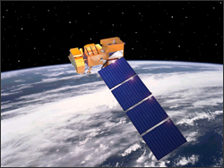
Landsat 7 Maneuvers to Avoid Space DebrisSource: USGS Landsat website
On April 17, 2012, Landsat 7 maneuvered out of the path of a piece of debris that was on a collision course with the spacecraft. This move will affect the location of the data imaged. As a result, the geographic coverage of collected imagery will drift to the west until the easternmost portion of the scene will be missing as compared to previous acquisitions. The most affected region will be the Tropics, which will begin seeing a small offset on or around April 25. The westward movement will continue until the USGS Flight Operations Team can maneuver and reposition the satellite to its proper orbit. This process is expected to take approximately 2 months, and the USGS will continue to acquire data during this time. Details about returning to nominal orbit will be announced when they become available. In 1957 after the beginning of the space race (started by the launch of Sputnik),the North American Aerospace Defense Command (NORAD) started compiling a database of all known debris. The Department of Defense maintains a highly accurate satellite catalog on objects in Earth orbit that are larger than a softball. NASA and the DoD cooperate and share responsibilities for characterizing the satellite (including orbital debris) environment. |